Crow Mesa East Topo Map New Mexico
To zoom in, hover over the map of Crow Mesa East
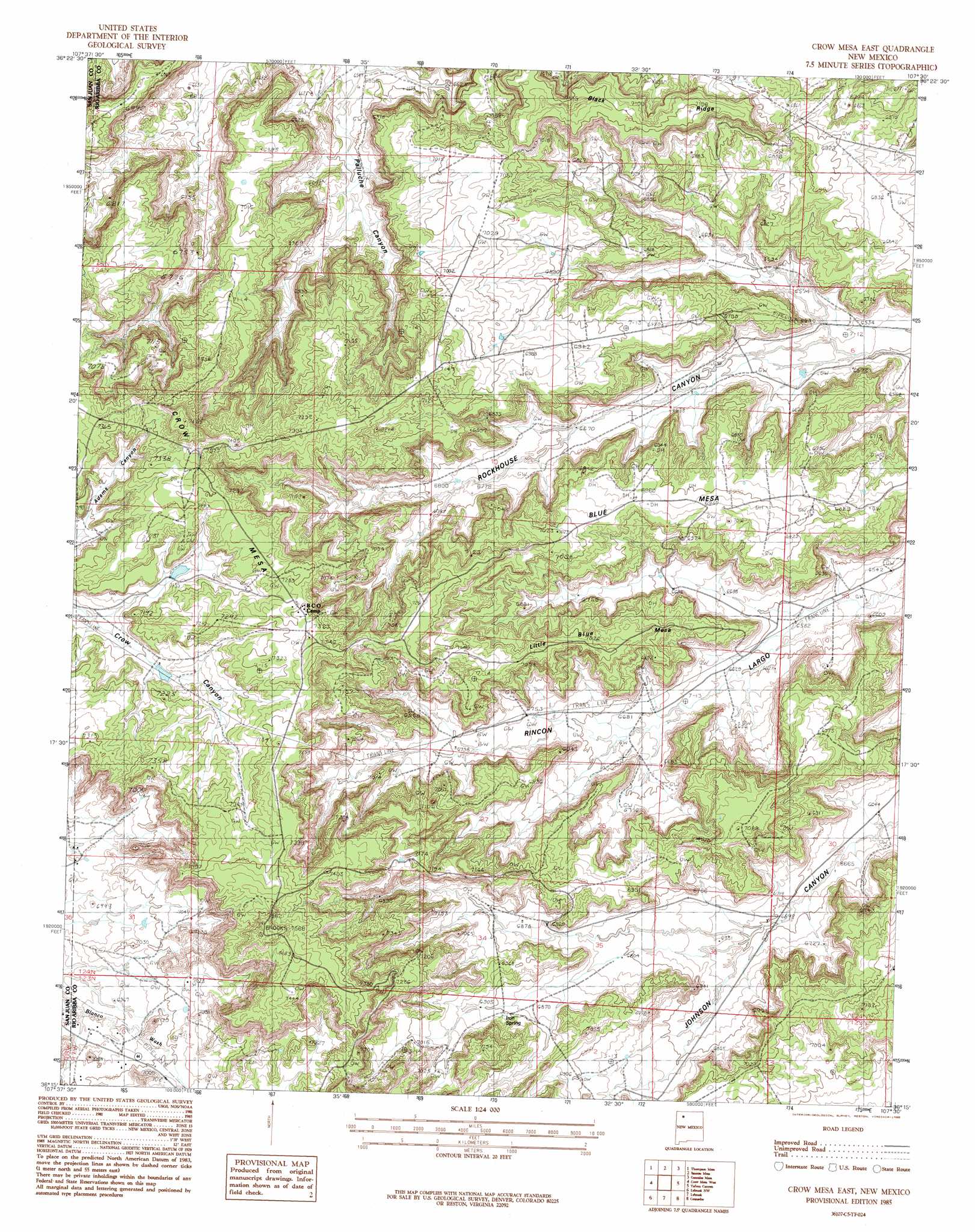
USGS Topo Quad 36107c5 - 1:24,000 scale
| Topo Map Name: | Crow Mesa East |
| USGS Topo Quad ID: | 36107c5 |
| Print Size: | ca. 21 1/4" wide x 27" high |
| Southeast Coordinates: | 36.25° N latitude / 107.5° W longitude |
| Map Center Coordinates: | 36.3125° N latitude / 107.5625° W longitude |
| U.S. State: | NM |
| Filename: | o36107c5.jpg |
| Download Map JPG Image: | Crow Mesa East topo map 1:24,000 scale |
| Map Type: | Topographic |
| Topo Series: | 7.5´ |
| Map Scale: | 1:24,000 |
| Source of Map Images: | United States Geological Survey (USGS) |
| Alternate Map Versions: |
Crow Mesa East NM 1985, updated 1985 Download PDF Buy paper map Crow Mesa East NM 2010 Download PDF Buy paper map Crow Mesa East NM 2013 Download PDF Buy paper map |
1:24,000 Topo Quads surrounding Crow Mesa East
Huerfanito Peak |
Fresno Canyon |
Gould Pass |
Santos Peak |
Vigas Canyon |
Huerfano Trading Post |
Thompson Mesa |
Smouse Mesa |
Gonzales Mesa |
Lapis Point |
Blanco Trading Post |
Crow Mesa West |
Crow Mesa East |
Tafoya Canyon |
Otero Store |
Kimbeto |
Lybrook Nw |
Lybrook |
Counselor |
Tancosa Windmill |
Sargent Ranch |
Fire Rock Well |
Lybrook Se |
Mule Dam |
Deer Mesa |
> Back to 36107a1 at 1:100,000 scale
> Back to 36106a1 at 1:250,000 scale
> Back to U.S. Topo Maps home
Crow Mesa East topo map: Gazetteer
Crow Mesa East: Oilfields
Devils Fork Gas Field elevation 2013m 6604′Escrito Oil Field elevation 2131m 6991′
Crow Mesa East: Ridges
Black Ridge elevation 2157m 7076′Crow Mesa East: Springs
Iron Spring elevation 2107m 6912′Crow Mesa East: Summits
Blue Mesa elevation 2166m 7106′Little Blue Mesa elevation 2192m 7191′
Crow Mesa East digital topo map on disk
Buy this Crow Mesa East topo map showing relief, roads, GPS coordinates and other geographical features, as a high-resolution digital map file on DVD: