Santos Peak Topo Map New Mexico
To zoom in, hover over the map of Santos Peak
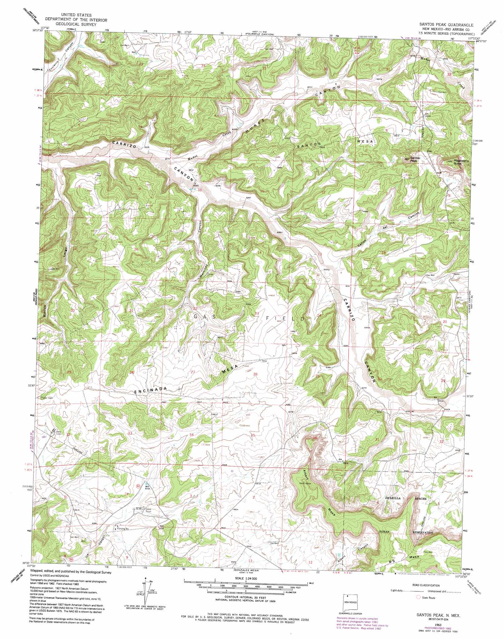
USGS Topo Quad 36107e4 - 1:24,000 scale
| Topo Map Name: | Santos Peak |
| USGS Topo Quad ID: | 36107e4 |
| Print Size: | ca. 21 1/4" wide x 27" high |
| Southeast Coordinates: | 36.5° N latitude / 107.375° W longitude |
| Map Center Coordinates: | 36.5625° N latitude / 107.4375° W longitude |
| U.S. State: | NM |
| Filename: | o36107e4.jpg |
| Download Map JPG Image: | Santos Peak topo map 1:24,000 scale |
| Map Type: | Topographic |
| Topo Series: | 7.5´ |
| Map Scale: | 1:24,000 |
| Source of Map Images: | United States Geological Survey (USGS) |
| Alternate Map Versions: |
Santos Peak NM 1963, updated 1966 Download PDF Buy paper map Santos Peak NM 1963, updated 1983 Download PDF Buy paper map Santos Peak NM 1963, updated 1991 Download PDF Buy paper map Santos Peak NM 2010 Download PDF Buy paper map Santos Peak NM 2013 Download PDF Buy paper map Santos Peak NM 2017 Download PDF Buy paper map |
1:24,000 Topo Quads surrounding Santos Peak
Archuleta |
Navajo Dam |
Gomez Ranch |
Espinosa Ranch |
Bixler Ranch |
Cutter Canyon |
Delgadito Mesa |
Fourmile Canyon |
Gobernador |
Leandro Canyon |
Fresno Canyon |
Gould Pass |
Santos Peak |
Vigas Canyon |
Pine Lake |
Thompson Mesa |
Smouse Mesa |
Gonzales Mesa |
Lapis Point |
Schmitz Ranch |
Crow Mesa West |
Crow Mesa East |
Tafoya Canyon |
Otero Store |
Billy Rice Canyon |
> Back to 36107e1 at 1:100,000 scale
> Back to 36106a1 at 1:250,000 scale
> Back to U.S. Topo Maps home
Santos Peak topo map: Gazetteer
Santos Peak: Streams
Muñoz Creek elevation 1897m 6223′Santos Peak: Summits
Albert Mesa elevation 2143m 7030′Magdalena Butte elevation 2142m 7027′
Santos Mesa elevation 2038m 6686′
Santos Peak elevation 2134m 7001′
Santos Peak: Valleys
Cañon de Camino elevation 1925m 6315′Martinez Canyon elevation 1902m 6240′
Muñoz Canyon elevation 1897m 6223′
Rincon Largo elevation 1876m 6154′
Santos Peak: Wells
Lowry 3 Water Well elevation 1997m 6551′Lowry 4 Water Well elevation 1997m 6551′
Lowry 5 Water Well elevation 2018m 6620′
Santos Peak digital topo map on disk
Buy this Santos Peak topo map showing relief, roads, GPS coordinates and other geographical features, as a high-resolution digital map file on DVD: