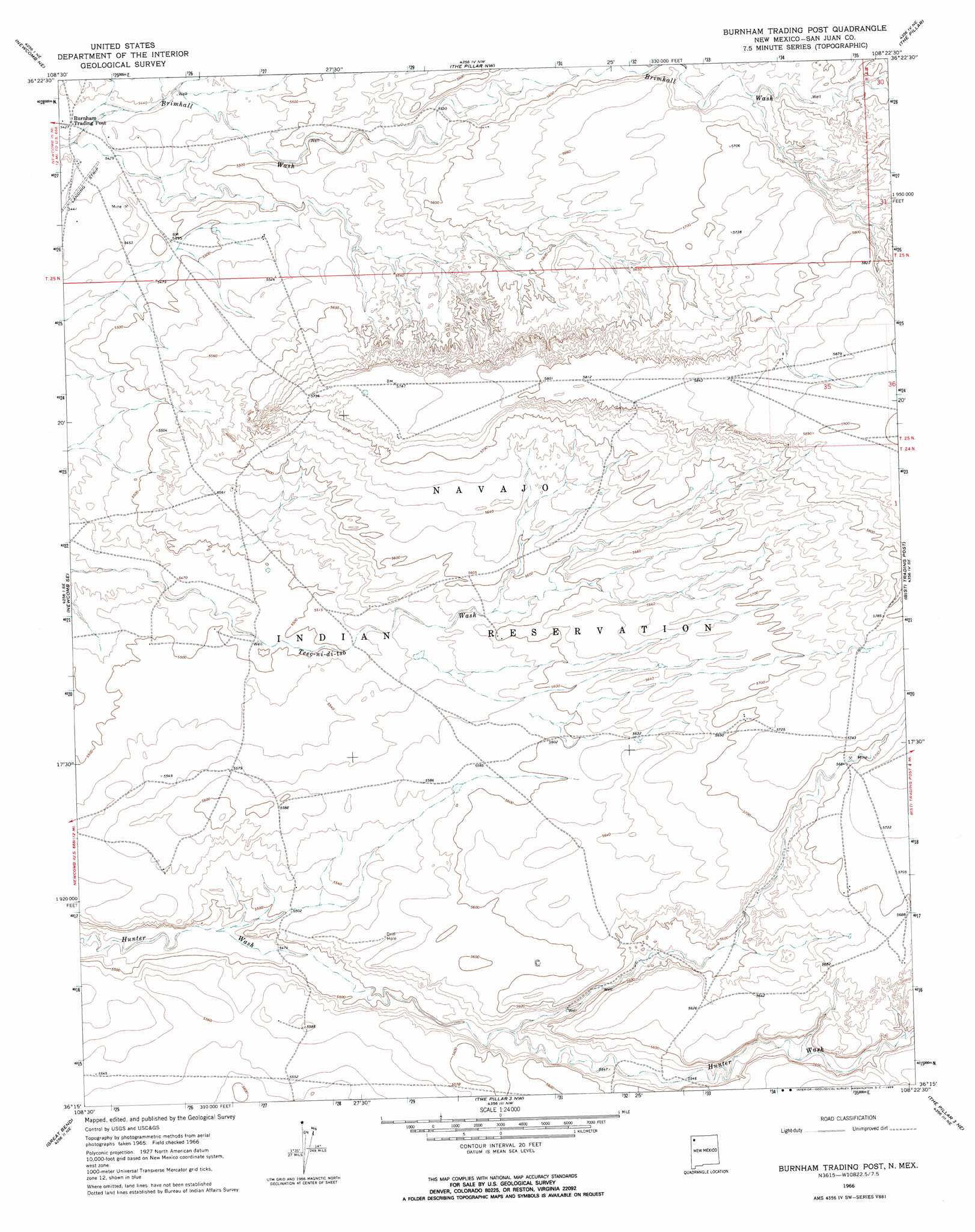
Burnham Trading Post Topo Map New Mexico
To zoom in, hover over the map of Burnham Trading Post
USGS Topo Quad 36108c4 - 1:24,000 scale
| Topo Map Name: | Burnham Trading Post |
| USGS Topo Quad ID: | 36108c4 |
| Print Size: | ca. 21 1/4" wide x 27" high |
| Southeast Coordinates: | 36.25° N latitude / 108.375° W longitude |
| Map Center Coordinates: | 36.3125° N latitude / 108.4375° W longitude |
| U.S. State: | NM |
| Filename: | o36108c4.jpg |
| Download Map JPG Image: | Burnham Trading Post topo map 1:24,000 scale |
| Map Type: | Topographic |
| Topo Series: | 7.5´ |
| Map Scale: | 1:24,000 |
| Source of Map Images: | United States Geological Survey (USGS) |
| Alternate Map Versions: |
Burnham Trading Post NM 1966, updated 1969 Download PDF Buy paper map Burnham Trading Post NM 1966, updated 1969 Download PDF Buy paper map Burnham Trading Post NM 2010 Download PDF Buy paper map Burnham Trading Post NM 2013 Download PDF Buy paper map Burnham Trading Post NM 2017 Download PDF Buy paper map |
1:24,000 Topo Quads surrounding Burnham Trading Post
Table Mesa |
The Hogback South |
Kirtland Sw |
Kirtland Se |
Hugh Lake |
Little Water |
Newcomb Ne |
The Pillar Nw |
The Pillar |
Moncisco Wash |
Newcomb |
Newcomb Se |
Burnham Trading Post |
Bisti Trading Post |
Alamo Mesa West |
Sheep Springs |
Great Bend |
The Pillar 3 Nw |
The Pillar 3 Ne |
Tanner Lake |
Naschitti |
Grey Hill Spring |
The Pillar 2 Sw |
The Pillar 3 Se |
La Vida Mission |
> Back to 36108a1 at 1:100,000 scale
> Back to 36108a1 at 1:250,000 scale
> Back to U.S. Topo Maps home
Burnham Trading Post topo map: Gazetteer
Burnham Trading Post: Wells
13T-501 Water Well elevation 1659m 5442′13T-514 Water Well elevation 1761m 5777′
Burnham Trading Post digital topo map on disk
Buy this Burnham Trading Post topo map showing relief, roads, GPS coordinates and other geographical features, as a high-resolution digital map file on DVD: