The Pillar Nw Topo Map New Mexico
To zoom in, hover over the map of The Pillar Nw
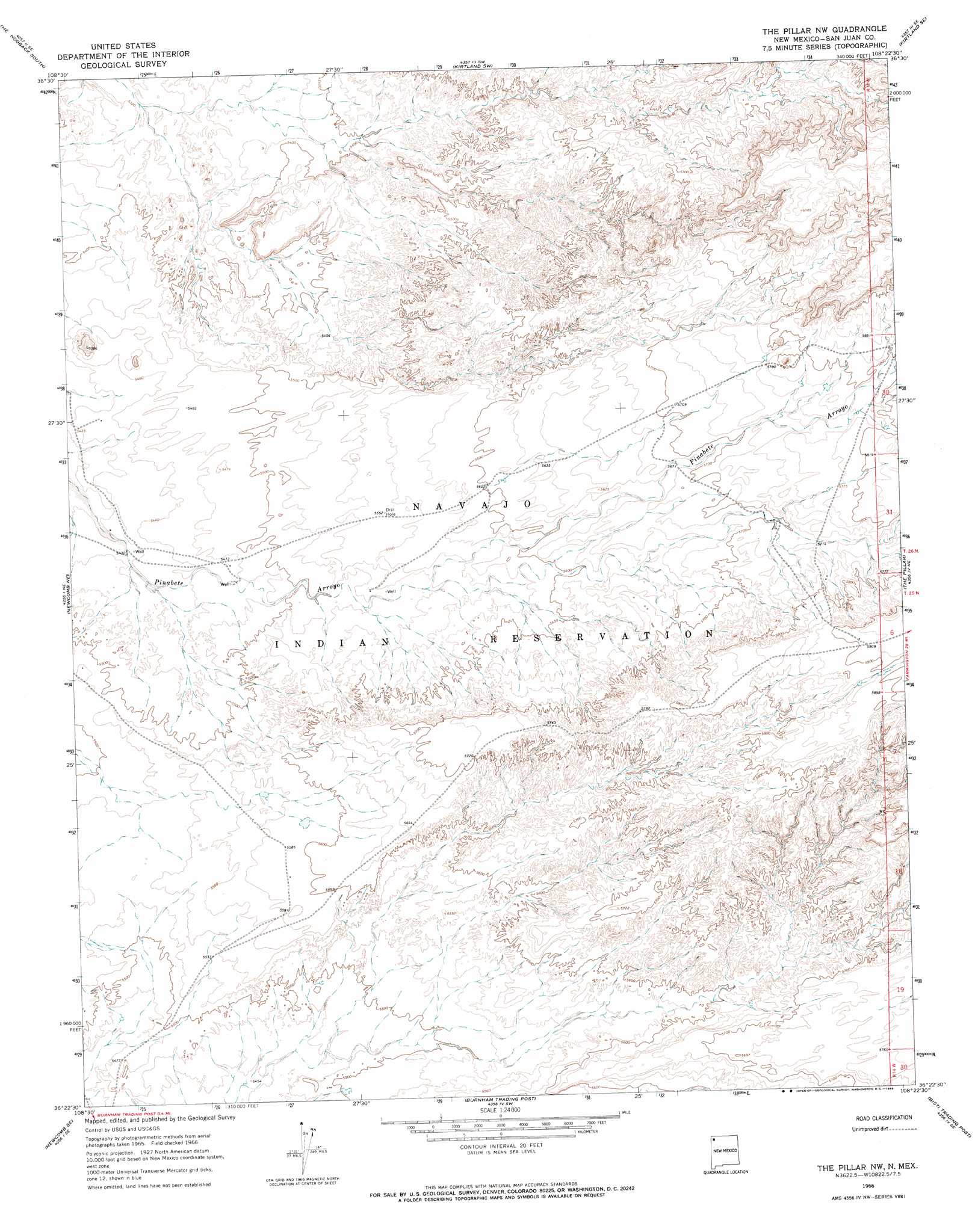
USGS Topo Quad 36108d4 - 1:24,000 scale
| Topo Map Name: | The Pillar Nw |
| USGS Topo Quad ID: | 36108d4 |
| Print Size: | ca. 21 1/4" wide x 27" high |
| Southeast Coordinates: | 36.375° N latitude / 108.375° W longitude |
| Map Center Coordinates: | 36.4375° N latitude / 108.4375° W longitude |
| U.S. State: | NM |
| Filename: | o36108d4.jpg |
| Download Map JPG Image: | The Pillar Nw topo map 1:24,000 scale |
| Map Type: | Topographic |
| Topo Series: | 7.5´ |
| Map Scale: | 1:24,000 |
| Source of Map Images: | United States Geological Survey (USGS) |
| Alternate Map Versions: |
The Pillar NW NM 1966, updated 1969 Download PDF Buy paper map The Pillar NW NM 2010 Download PDF Buy paper map The Pillar NW NM 2013 Download PDF Buy paper map The Pillar NW NM 2017 Download PDF Buy paper map |
1:24,000 Topo Quads surrounding The Pillar Nw
Sulphur Spring |
The Hogack North |
Fruitland |
Kirtland |
Farmington South |
Table Mesa |
The Hogback South |
Kirtland Sw |
Kirtland Se |
Hugh Lake |
Little Water |
Newcomb Ne |
The Pillar Nw |
The Pillar |
Moncisco Wash |
Newcomb |
Newcomb Se |
Burnham Trading Post |
Bisti Trading Post |
Alamo Mesa West |
Sheep Springs |
Great Bend |
The Pillar 3 Nw |
The Pillar 3 Ne |
Tanner Lake |
> Back to 36108a1 at 1:100,000 scale
> Back to 36108a1 at 1:250,000 scale
> Back to U.S. Topo Maps home
No gazetteer data is available for the The Pillar Nw topo map sheet.
The Pillar Nw digital topo map on disk
Buy this The Pillar Nw topo map showing relief, roads, GPS coordinates and other geographical features, as a high-resolution digital map file on DVD: