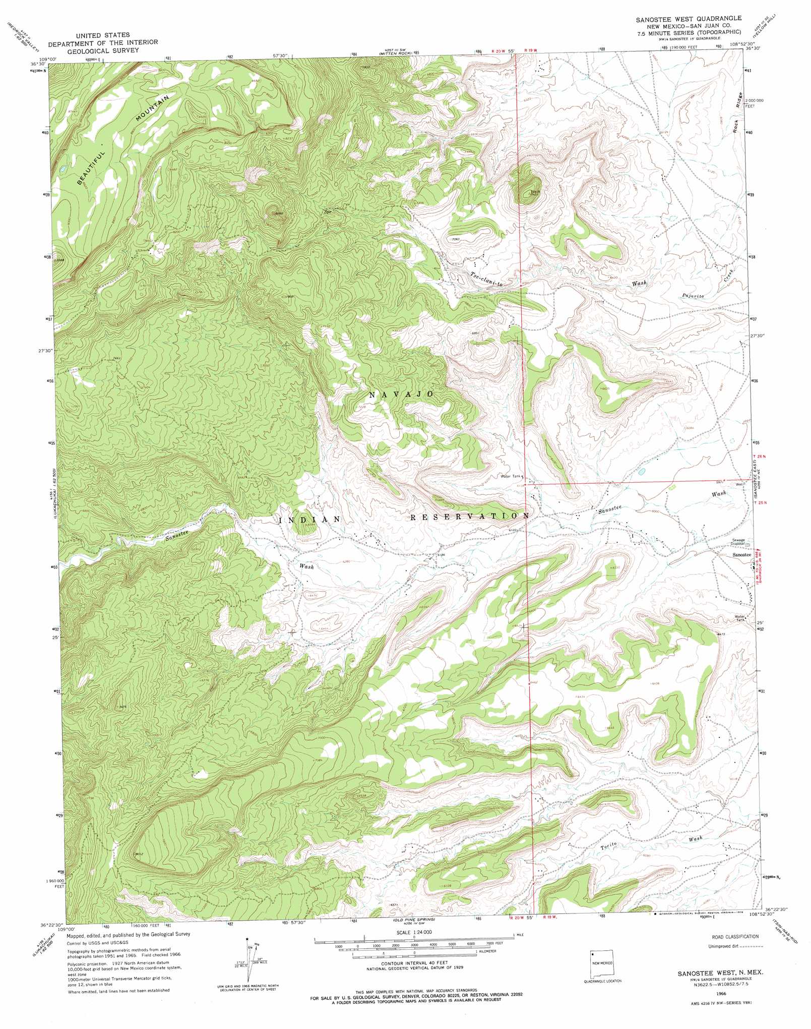
Sanostee West Topo Map New Mexico
To zoom in, hover over the map of Sanostee West
USGS Topo Quad 36108d8 - 1:24,000 scale
| Topo Map Name: | Sanostee West |
| USGS Topo Quad ID: | 36108d8 |
| Print Size: | ca. 21 1/4" wide x 27" high |
| Southeast Coordinates: | 36.375° N latitude / 108.875° W longitude |
| Map Center Coordinates: | 36.4375° N latitude / 108.9375° W longitude |
| U.S. State: | NM |
| Filename: | o36108d8.jpg |
| Download Map JPG Image: | Sanostee West topo map 1:24,000 scale |
| Map Type: | Topographic |
| Topo Series: | 7.5´ |
| Map Scale: | 1:24,000 |
| Source of Map Images: | United States Geological Survey (USGS) |
| Alternate Map Versions: |
Sanostee West NM 1966, updated 1969 Download PDF Buy paper map Sanostee West NM 1966, updated 1978 Download PDF Buy paper map Sanostee West NM 2010 Download PDF Buy paper map Sanostee West NM 2013 Download PDF Buy paper map Sanostee West NM 2017 Download PDF Buy paper map |
1:24,000 Topo Quads surrounding Sanostee West
Boiling Over Well |
Horse Mesa |
Sand Spring |
Ship Rock |
Sulphur Spring |
Cove |
Red Valley |
Mitten Rock |
Yellow Hill |
Table Mesa |
Lukachukai |
Roof Butte |
Sanostee West |
Sanostee East |
Little Water |
Tsaile |
Tsaile Butte |
Old Pine Spring |
Tsin-Nas-Kid |
Newcomb |
Lower Wheatfields |
Upper Wheatfields |
Toadlena |
Two Grey Hills |
Sheep Springs |
> Back to 36108a1 at 1:100,000 scale
> Back to 36108a1 at 1:250,000 scale
> Back to U.S. Topo Maps home
Sanostee West topo map: Gazetteer
Sanostee West: Mines
Sanostee Prospect elevation 2027m 6650′Sanostee West: Summits
Beautiful Mountain elevation 2696m 8845′Carona de Gigante elevation 1859m 6099′
Sanostee West: Wells
12T-512 Water Well elevation 1815m 5954′12T-516 Water Well elevation 1938m 6358′
12T-570 Water Well elevation 1969m 6459′
12T-631 Water Well elevation 1878m 6161′
NA-79-204 Water Well elevation 1856m 6089′
PM2 Water Well elevation 1844m 6049′
Sanostee PM3 Water Well elevation 1830m 6003′
Sanostee West digital topo map on disk
Buy this Sanostee West topo map showing relief, roads, GPS coordinates and other geographical features, as a high-resolution digital map file on DVD: