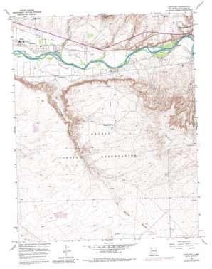
Kirtland Topo Map New Mexico
To zoom in, hover over the map of Kirtland
USGS Topo Quad 36108f3 - 1:24,000 scale
| Topo Map Name: | Kirtland |
| USGS Topo Quad ID: | 36108f3 |
| Print Size: | ca. 21 1/4" wide x 27" high |
| Southeast Coordinates: | 36.625° N latitude / 108.25° W longitude |
| Map Center Coordinates: | 36.6875° N latitude / 108.3125° W longitude |
| U.S. State: | NM |
| Filename: | o36108f3.jpg |
| Download Map JPG Image: | Kirtland topo map 1:24,000 scale |
| Map Type: | Topographic |
| Topo Series: | 7.5´ |
| Map Scale: | 1:24,000 |
| Source of Map Images: | United States Geological Survey (USGS) |
| Alternate Map Versions: |
Kirtland NM 1966, updated 1969 Download PDF Buy paper map Kirtland NM 1966, updated 1980 Download PDF Buy paper map Kirtland NM 2010 Download PDF Buy paper map Kirtland NM 2013 Download PDF Buy paper map Kirtland NM 2017 Download PDF Buy paper map |
1:24,000 Topo Quads surrounding Kirtland
> Back to 36108e1 at 1:100,000 scale
> Back to 36108a1 at 1:250,000 scale
> Back to U.S. Topo Maps home
Kirtland topo map: Gazetteer
Kirtland: Airports
Davenport Airport elevation 1739m 5705′Kirtland: Mines
Harper Hill Pit elevation 1582m 5190′Kirtland: Populated Places
Kirtland elevation 1581m 5187′Ojo Amarillo elevation 1649m 5410′
Upper Fruitland elevation 1593m 5226′
Kirtland: Post Offices
Kirtland Post Office elevation 1581m 5187′Kirtland: Streams
Coolidge Arroyo elevation 1571m 5154′Dain Arroyo elevation 1577m 5173′
La Plata River elevation 1589m 5213′
Locke Arroyo elevation 1578m 5177′
Kirtland: Summits
Twin Mounds elevation 1725m 5659′Twin Mountain elevation 1643m 5390′
Kirtland: Valleys
Ojo Amarillo Canyon elevation 1589m 5213′Kirtland digital topo map on disk
Buy this Kirtland topo map showing relief, roads, GPS coordinates and other geographical features, as a high-resolution digital map file on DVD:


