Ship Rock Topo Map New Mexico
To zoom in, hover over the map of Ship Rock
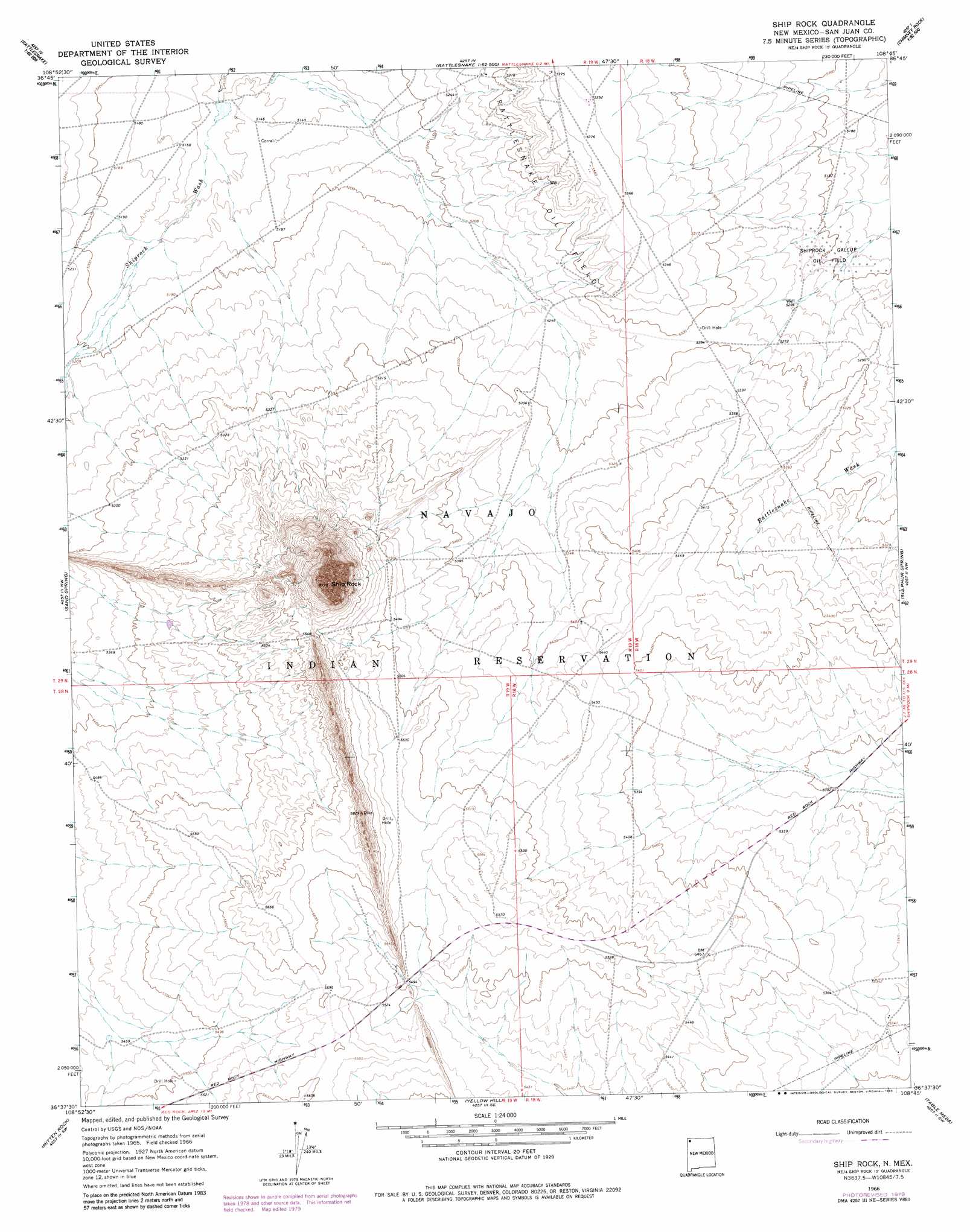
USGS Topo Quad 36108f7 - 1:24,000 scale
| Topo Map Name: | Ship Rock |
| USGS Topo Quad ID: | 36108f7 |
| Print Size: | ca. 21 1/4" wide x 27" high |
| Southeast Coordinates: | 36.625° N latitude / 108.75° W longitude |
| Map Center Coordinates: | 36.6875° N latitude / 108.8125° W longitude |
| U.S. State: | NM |
| Filename: | o36108f7.jpg |
| Download Map JPG Image: | Ship Rock topo map 1:24,000 scale |
| Map Type: | Topographic |
| Topo Series: | 7.5´ |
| Map Scale: | 1:24,000 |
| Source of Map Images: | United States Geological Survey (USGS) |
| Alternate Map Versions: |
Ship Rock NM 1966, updated 1969 Download PDF Buy paper map Ship Rock NM 1966, updated 1980 Download PDF Buy paper map Ship Rock NM 1966, updated 1980 Download PDF Buy paper map Ship Rock NM 2010 Download PDF Buy paper map Ship Rock NM 2013 Download PDF Buy paper map Ship Rock NM 2017 Download PDF Buy paper map |
1:24,000 Topo Quads surrounding Ship Rock
Teec Nos Pos |
Sallies Spring |
Canal Creek |
Skinney Rock |
Palmer Mesa |
Beclabito |
Rocky Point |
Rattlesnake |
Shiprock |
Chimney Rock |
Horse Mesa |
Sand Spring |
Ship Rock |
Sulphur Spring |
The Hogack North |
Red Valley |
Mitten Rock |
Yellow Hill |
Table Mesa |
The Hogback South |
Roof Butte |
Sanostee West |
Sanostee East |
Little Water |
Newcomb Ne |
> Back to 36108e1 at 1:100,000 scale
> Back to 36108a1 at 1:250,000 scale
> Back to U.S. Topo Maps home
Ship Rock topo map: Gazetteer
Ship Rock: Arroyos
Arroyo Del Pajarito elevation 1593m 5226′Ship Rock: Oilfields
Rattlesnake Oil Field elevation 1620m 5314′Shiprock Gallup Oil Field elevation 1586m 5203′
Ship Rock: Parks
Shiprock Historical Marker elevation 2166m 7106′Ship Rock: Summits
Ship Rock elevation 2166m 7106′Ship Rock digital topo map on disk
Buy this Ship Rock topo map showing relief, roads, GPS coordinates and other geographical features, as a high-resolution digital map file on DVD: