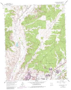
Farmington North Topo Map New Mexico
To zoom in, hover over the map of Farmington North
USGS Topo Quad 36108g2 - 1:24,000 scale
| Topo Map Name: | Farmington North |
| USGS Topo Quad ID: | 36108g2 |
| Print Size: | ca. 21 1/4" wide x 27" high |
| Southeast Coordinates: | 36.75° N latitude / 108.125° W longitude |
| Map Center Coordinates: | 36.8125° N latitude / 108.1875° W longitude |
| U.S. State: | NM |
| Filename: | o36108g2.jpg |
| Download Map JPG Image: | Farmington North topo map 1:24,000 scale |
| Map Type: | Topographic |
| Topo Series: | 7.5´ |
| Map Scale: | 1:24,000 |
| Source of Map Images: | United States Geological Survey (USGS) |
| Alternate Map Versions: |
Farmington North NM 1963, updated 1965 Download PDF Buy paper map Farmington North NM 1963, updated 1980 Download PDF Buy paper map Farmington North NM 2010 Download PDF Buy paper map Farmington North NM 2013 Download PDF Buy paper map Farmington North NM 2017 Download PDF Buy paper map |
1:24,000 Topo Quads surrounding Farmington North
> Back to 36108e1 at 1:100,000 scale
> Back to 36108a1 at 1:250,000 scale
> Back to U.S. Topo Maps home
Farmington North topo map: Gazetteer
Farmington North: Areas
The Badlands elevation 1647m 5403′Farmington North: Canals
Halford Independent Ditch elevation 1656m 5433′Jackson Ditch elevation 1661m 5449′
Pickering Ditch elevation 1651m 5416′
Star Ditch elevation 1651m 5416′
Farmington North: Dams
30th Street Dam elevation 1667m 5469′City Reser City of Farmington Dam elevation 1666m 5465′
Jackson Lake Dam elevation 1690m 5544′
Farmington North: Mines
Black Diamond Mine elevation 1730m 5675′Dobey Medina Mine elevation 1730m 5675′
Kutz Pit elevation 1730m 5675′
Lower San Juan Pit elevation 1730m 5675′
San Juan Pit elevation 1730m 5675′
Farmington North: Parks
Old Indian Racetrack Historic Site elevation 1647m 5403′Farmington North: Reservoirs
Basin Tank elevation 1807m 5928′City Reservoir elevation 1666m 5465′
East King Tank elevation 1707m 5600′
Gypsum Tank elevation 1794m 5885′
Jackson Lake elevation 1690m 5544′
Farmington North: Springs
Brown Spring elevation 1758m 5767′E Evans Spring elevation 1659m 5442′
Knight Spring elevation 1715m 5626′
Farmington North: Streams
Allen Arroyo elevation 1689m 5541′Barker Arroyo elevation 1679m 5508′
Connor Arroyo elevation 1634m 5360′
Cottonwood Arroyo elevation 1616m 5301′
Coyne Arroyo elevation 1663m 5456′
Hood Arroyo elevation 1640m 5380′
North Twin Wash elevation 1659m 5442′
Pickering Arroyo elevation 1662m 5452′
South Twin Wash elevation 1652m 5419′
Farmington North: Summits
Hood Mesa elevation 1800m 5905′Farmington North: Valleys
Chokecherry Canyon elevation 1710m 5610′Farmington North digital topo map on disk
Buy this Farmington North topo map showing relief, roads, GPS coordinates and other geographical features, as a high-resolution digital map file on DVD:


