Chimney Rock Topo Map New Mexico
To zoom in, hover over the map of Chimney Rock
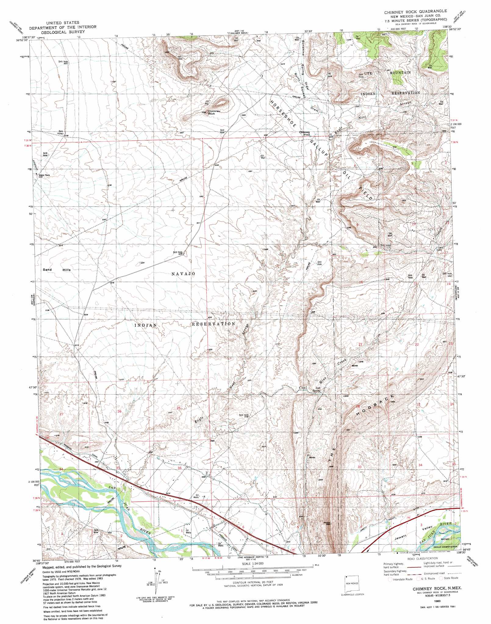
USGS Topo Quad 36108g5 - 1:24,000 scale
| Topo Map Name: | Chimney Rock |
| USGS Topo Quad ID: | 36108g5 |
| Print Size: | ca. 21 1/4" wide x 27" high |
| Southeast Coordinates: | 36.75° N latitude / 108.5° W longitude |
| Map Center Coordinates: | 36.8125° N latitude / 108.5625° W longitude |
| U.S. State: | NM |
| Filename: | o36108g5.jpg |
| Download Map JPG Image: | Chimney Rock topo map 1:24,000 scale |
| Map Type: | Topographic |
| Topo Series: | 7.5´ |
| Map Scale: | 1:24,000 |
| Source of Map Images: | United States Geological Survey (USGS) |
| Alternate Map Versions: |
Chimney Rock NM 1983, updated 1984 Download PDF Buy paper map Chimney Rock NM 2010 Download PDF Buy paper map Chimney Rock NM 2013 Download PDF Buy paper map Chimney Rock NM 2017 Download PDF Buy paper map |
1:24,000 Topo Quads surrounding Chimney Rock
Sentinel Peak Se |
Tanner Mesa |
Moqui Canyon |
Greasewood Canyon |
Red Horse Gulch |
Canal Creek |
Skinney Rock |
Palmer Mesa |
Heifer Point |
Purgatory Canyon |
Rattlesnake |
Shiprock |
Chimney Rock |
Waterflow |
Youngs Lake |
Ship Rock |
Sulphur Spring |
The Hogack North |
Fruitland |
Kirtland |
Yellow Hill |
Table Mesa |
The Hogback South |
Kirtland Sw |
Kirtland Se |
> Back to 36108e1 at 1:100,000 scale
> Back to 36108a1 at 1:250,000 scale
> Back to U.S. Topo Maps home
Chimney Rock topo map: Gazetteer
Chimney Rock: Areas
Jewett Valley elevation 1532m 5026′Chimney Rock: Lakes
Chimney Pond elevation 1625m 5331′Chimney Rock: Mines
Agency Coal Mine elevation 1613m 5291′Chimney Rock: Pillars
Chimney Rock elevation 1691m 5547′Chimney Rock: Ridges
Sand Hills elevation 1601m 5252′Chimney Rock: Springs
Salt Spring elevation 1582m 5190′Chimney Rock: Streams
Coal Mine Creek elevation 1552m 5091′Eagle Nest Arroyo elevation 1512m 4960′
Chimney Rock: Valleys
Burnt Squash Draw elevation 1615m 5298′Sunshine Spring Draw elevation 1639m 5377′
Chimney Rock: Wells
OT-1 Water Well elevation 1590m 5216′WS-2 Water Well elevation 1659m 5442′
WS-3 Water Well elevation 1636m 5367′
WS-4 Water Well elevation 1639m 5377′
WS-5 Water Well elevation 1626m 5334′
Chimney Rock digital topo map on disk
Buy this Chimney Rock topo map showing relief, roads, GPS coordinates and other geographical features, as a high-resolution digital map file on DVD: