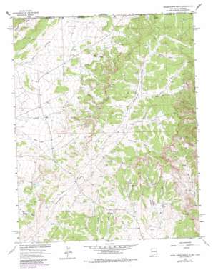
Abode Downs Ranch Topo Map New Mexico
To zoom in, hover over the map of Abode Downs Ranch
USGS Topo Quad 36108h1 - 1:24,000 scale
| Topo Map Name: | Abode Downs Ranch |
| USGS Topo Quad ID: | 36108h1 |
| Print Size: | ca. 21 1/4" wide x 27" high |
| Southeast Coordinates: | 36.875° N latitude / 108° W longitude |
| Map Center Coordinates: | 36.9375° N latitude / 108.0625° W longitude |
| U.S. States: | NM, CO |
| Filename: | o36108h1.jpg |
| Download Map JPG Image: | Abode Downs Ranch topo map 1:24,000 scale |
| Map Type: | Topographic |
| Topo Series: | 7.5´ |
| Map Scale: | 1:24,000 |
| Source of Map Images: | United States Geological Survey (USGS) |
| Alternate Map Versions: |
Adobe Downs Ranch NM 1963, updated 1965 Download PDF Buy paper map Adobe Downs Ranch NM 1963, updated 1980 Download PDF Buy paper map Adobe Downs Ranch NM 2010 Download PDF Buy paper map Adobe Downs Ranch NM 2013 Download PDF Buy paper map Adobe Downs Ranch NM 2017 Download PDF Buy paper map |
1:24,000 Topo Quads surrounding Abode Downs Ranch
> Back to 36108e1 at 1:100,000 scale
> Back to 36108a1 at 1:250,000 scale
> Back to U.S. Topo Maps home
Abode Downs Ranch topo map: Gazetteer
Abode Downs Ranch: Canals
McDermott Ditch elevation 1861m 6105′Abode Downs Ranch: Dams
Camel Hump Dam elevation 1848m 6062′Drip Pee Wee Dam elevation 1921m 6302′
Hedges North Dam elevation 1886m 6187′
Knob Rock Dam elevation 1839m 6033′
Painted Hills Dam elevation 1872m 6141′
Pee Wee Dam elevation 1915m 6282′
Vee Dam elevation 1909m 6263′
White Hill Dam elevation 1830m 6003′
Zebra Hills Dam elevation 1855m 6085′
Abode Downs Ranch: Flats
Jaquez Flat elevation 1863m 6112′Abode Downs Ranch: Levees
Oliver Dike elevation 1814m 5951′Abode Downs Ranch: Mines
New Mexico Mine elevation 1874m 6148′Abode Downs Ranch: Springs
Coyote Spring elevation 1992m 6535′Mosley Spring elevation 1898m 6227′
Abode Downs Ranch: Streams
Black Glade elevation 1946m 6384′Dusenberry Glade elevation 1917m 6289′
Lawson Glade elevation 1919m 6295′
Martin Glade elevation 1992m 6535′
Abode Downs Ranch digital topo map on disk
Buy this Abode Downs Ranch topo map showing relief, roads, GPS coordinates and other geographical features, as a high-resolution digital map file on DVD:


