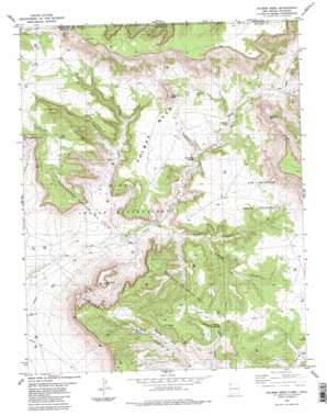
Palmer Mesa Topo Map New Mexico
To zoom in, hover over the map of Palmer Mesa
USGS Topo Quad 36108h5 - 1:24,000 scale
| Topo Map Name: | Palmer Mesa |
| USGS Topo Quad ID: | 36108h5 |
| Print Size: | ca. 21 1/4" wide x 27" high |
| Southeast Coordinates: | 36.875° N latitude / 108.5° W longitude |
| Map Center Coordinates: | 36.9375° N latitude / 108.5625° W longitude |
| U.S. States: | NM, CO |
| Filename: | o36108h5.jpg |
| Download Map JPG Image: | Palmer Mesa topo map 1:24,000 scale |
| Map Type: | Topographic |
| Topo Series: | 7.5´ |
| Map Scale: | 1:24,000 |
| Source of Map Images: | United States Geological Survey (USGS) |
| Alternate Map Versions: |
Palmer Mesa NM 1983, updated 1984 Download PDF Buy paper map Palmer Mesa NM 2011 Download PDF Buy paper map Palmer Mesa NM 2013 Download PDF Buy paper map Palmer Mesa NM 2017 Download PDF Buy paper map |
1:24,000 Topo Quads surrounding Palmer Mesa
> Back to 36108e1 at 1:100,000 scale
> Back to 36108a1 at 1:250,000 scale
> Back to U.S. Topo Maps home
Palmer Mesa topo map: Gazetteer
Palmer Mesa: Oilfields
Many Rocks Gallup Oil Field elevation 1696m 5564′Palmer Mesa: Springs
Sunshine Spring elevation 1753m 5751′Palmer Mesa: Summits
Mesa Verde elevation 1737m 5698′Monument Rocks elevation 1796m 5892′
Palmer Mesa elevation 1750m 5741′
Popping Rock elevation 1835m 6020′
Thieving Rock elevation 1913m 6276′
Palmer Mesa: Valleys
Gum Canyon elevation 1606m 5269′North Salt Canyon elevation 1705m 5593′
North Salt Canyon elevation 1708m 5603′
Rocky Canyon elevation 1615m 5298′
Salt Canyon elevation 1705m 5593′
Salt Canyon elevation 1704m 5590′
Standing Tree Canyon elevation 1643m 5390′
West Gum Canyon elevation 1819m 5967′
Palmer Mesa: Wells
A-12 Water Well elevation 1734m 5688′Palmer Mesa digital topo map on disk
Buy this Palmer Mesa topo map showing relief, roads, GPS coordinates and other geographical features, as a high-resolution digital map file on DVD:


