Canal Creek Topo Map New Mexico
To zoom in, hover over the map of Canal Creek
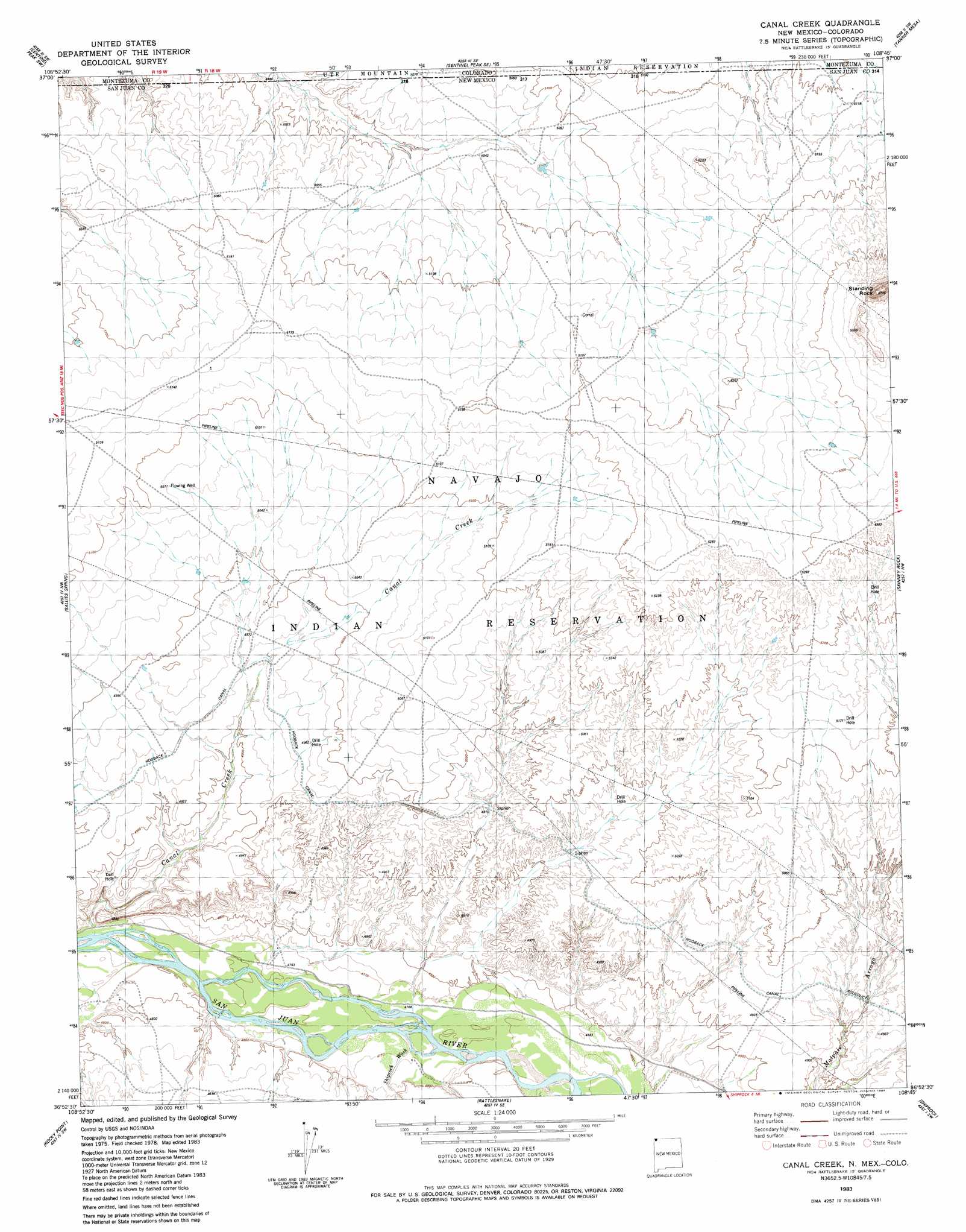
USGS Topo Quad 36108h7 - 1:24,000 scale
| Topo Map Name: | Canal Creek |
| USGS Topo Quad ID: | 36108h7 |
| Print Size: | ca. 21 1/4" wide x 27" high |
| Southeast Coordinates: | 36.875° N latitude / 108.75° W longitude |
| Map Center Coordinates: | 36.9375° N latitude / 108.8125° W longitude |
| U.S. States: | NM, CO |
| Filename: | o36108h7.jpg |
| Download Map JPG Image: | Canal Creek topo map 1:24,000 scale |
| Map Type: | Topographic |
| Topo Series: | 7.5´ |
| Map Scale: | 1:24,000 |
| Source of Map Images: | United States Geological Survey (USGS) |
| Alternate Map Versions: |
Canal Creek NM 1983, updated 1984 Download PDF Buy paper map Canal Creek NM 2010 Download PDF Buy paper map Canal Creek NM 2013 Download PDF Buy paper map |
1:24,000 Topo Quads surrounding Canal Creek
Peters Nipple |
Mariano Wash West |
Mariano Wash East |
Towaoc |
Wetherill Mesa |
Aneth Se |
Sentinel Peak Sw |
Sentinel Peak Se |
Tanner Mesa |
Moqui Canyon |
Teec Nos Pos |
Sallies Spring |
Canal Creek |
Skinney Rock |
Palmer Mesa |
Beclabito |
Rocky Point |
Rattlesnake |
Shiprock |
Chimney Rock |
Horse Mesa |
Sand Spring |
Ship Rock |
Sulphur Spring |
The Hogack North |
> Back to 36108e1 at 1:100,000 scale
> Back to 36108a1 at 1:250,000 scale
> Back to U.S. Topo Maps home
Canal Creek topo map: Gazetteer
Canal Creek: Pillars
Standing Rock elevation 1745m 5725′Canal Creek: Streams
Shiprock Wash elevation 1452m 4763′Canal Creek: Summits
Volcano Peak elevation 1552m 5091′Canal Creek: Wells
12K-317 Water Well elevation 1569m 5147′12T-505 Water Well elevation 1579m 5180′
Canal Creek digital topo map on disk
Buy this Canal Creek topo map showing relief, roads, GPS coordinates and other geographical features, as a high-resolution digital map file on DVD: