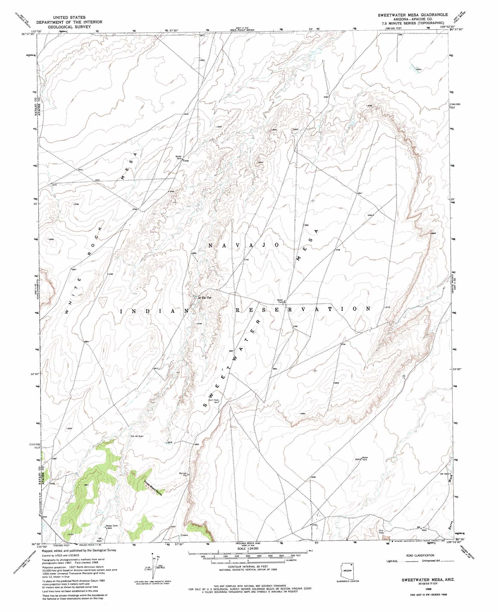
Sweetwater Mesa Topo Map Arizona
To zoom in, hover over the map of Sweetwater Mesa
USGS Topo Quad 36109e8 - 1:24,000 scale
| Topo Map Name: | Sweetwater Mesa |
| USGS Topo Quad ID: | 36109e8 |
| Print Size: | ca. 21 1/4" wide x 27" high |
| Southeast Coordinates: | 36.5° N latitude / 109.875° W longitude |
| Map Center Coordinates: | 36.5625° N latitude / 109.9375° W longitude |
| U.S. State: | AZ |
| Filename: | o36109e8.jpg |
| Download Map JPG Image: | Sweetwater Mesa topo map 1:24,000 scale |
| Map Type: | Topographic |
| Topo Series: | 7.5´ |
| Map Scale: | 1:24,000 |
| Source of Map Images: | United States Geological Survey (USGS) |
| Alternate Map Versions: |
Sweetwater Mesa AZ 1968, updated 1972 Download PDF Buy paper map Sweetwater Mesa AZ 1968, updated 1985 Download PDF Buy paper map Sweetwater Mesa AZ 2011 Download PDF Buy paper map Sweetwater Mesa AZ 2014 Download PDF Buy paper map |
1:24,000 Topo Quads surrounding Sweetwater Mesa
Agathla Peak |
Baby Rocks |
Red Point |
Dennehotso |
Mexican Water Sw |
Kayenta East |
Church Rock |
Red Point Mesa |
Tall Mesa |
Rock Point |
Owl Spring |
Chilchinbito |
Sweetwater Mesa |
White Point |
Rock Point Sw |
Cliff Rose Hill |
Chilchinbito Canyon |
Rough Rock Nw |
Rough Rock |
Windy Valley |
Toh Ne Zhonnie Spring |
Hole In Rock Valley |
Tah Chee Wash |
Sweathouse Peak |
Many Farms Sw |
> Back to 36109e1 at 1:100,000 scale
> Back to 36108a1 at 1:250,000 scale
> Back to U.S. Topo Maps home
Sweetwater Mesa topo map: Gazetteer
Sweetwater Mesa: Lakes
Toh Ah Glau elevation 1786m 5859′Sweetwater Mesa: Pillars
Three Black Rocks elevation 1851m 6072′Sweetwater Mesa: Springs
Al Tse Toh elevation 1732m 5682′Sweetwater Mesa: Summits
Sweetwater Mesa elevation 1755m 5757′White Rock Mesa elevation 1742m 5715′
Sweetwater Mesa digital topo map on disk
Buy this Sweetwater Mesa topo map showing relief, roads, GPS coordinates and other geographical features, as a high-resolution digital map file on DVD: