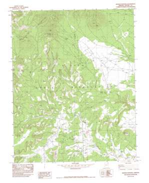
Boiling Over Well Topo Map Arizona
To zoom in, hover over the map of Boiling Over Well
USGS Topo Quad 36109f2 - 1:24,000 scale
| Topo Map Name: | Boiling Over Well |
| USGS Topo Quad ID: | 36109f2 |
| Print Size: | ca. 21 1/4" wide x 27" high |
| Southeast Coordinates: | 36.625° N latitude / 109.125° W longitude |
| Map Center Coordinates: | 36.6875° N latitude / 109.1875° W longitude |
| U.S. State: | AZ |
| Filename: | o36109f2.jpg |
| Download Map JPG Image: | Boiling Over Well topo map 1:24,000 scale |
| Map Type: | Topographic |
| Topo Series: | 7.5´ |
| Map Scale: | 1:24,000 |
| Source of Map Images: | United States Geological Survey (USGS) |
| Alternate Map Versions: |
Redrock Valley NW AZ 1953, updated 1954 Download PDF Buy paper map Boiling Over Well AZ 1982, updated 1982 Download PDF Buy paper map Boiling Over Well AZ 2011 Download PDF Buy paper map Boiling Over Well AZ 2014 Download PDF Buy paper map |
1:24,000 Topo Quads surrounding Boiling Over Well
> Back to 36109e1 at 1:100,000 scale
> Back to 36108a1 at 1:250,000 scale
> Back to U.S. Topo Maps home
Boiling Over Well topo map: Gazetteer
Boiling Over Well: Arches
Blackhorse Arch elevation 2046m 6712′Elephant Rock elevation 1915m 6282′
Boiling Over Well: Mines
Tohe Thlany Begay Mine elevation 2509m 8231′Boiling Over Well: Springs
Hidden Spring elevation 1945m 6381′Boiling Over Well: Streams
Blackhorse Creek elevation 1743m 5718′Boiling Over Well: Summits
Black Rock elevation 2020m 6627′Boiling Over Well: Valleys
Boiling Over Wash elevation 1829m 6000′Redrock Valley elevation 1974m 6476′
Boiling Over Well: Wells
Boiling Over Well elevation 1872m 6141′Boiling Over Well digital topo map on disk
Buy this Boiling Over Well topo map showing relief, roads, GPS coordinates and other geographical features, as a high-resolution digital map file on DVD:


