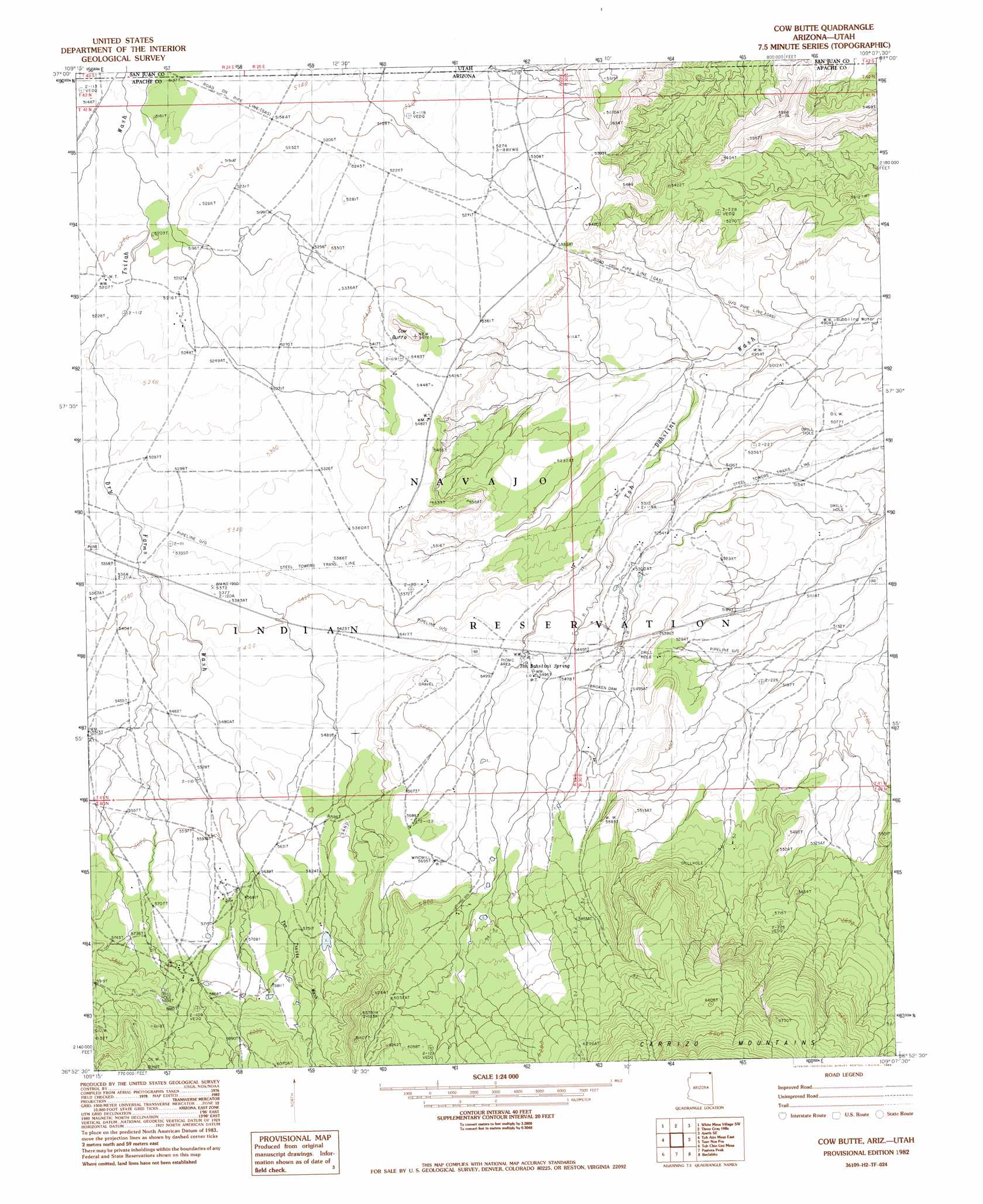
Cow Butte Topo Map Arizona
To zoom in, hover over the map of Cow Butte
USGS Topo Quad 36109h2 - 1:24,000 scale
| Topo Map Name: | Cow Butte |
| USGS Topo Quad ID: | 36109h2 |
| Print Size: | ca. 21 1/4" wide x 27" high |
| Southeast Coordinates: | 36.875° N latitude / 109.125° W longitude |
| Map Center Coordinates: | 36.9375° N latitude / 109.1875° W longitude |
| U.S. States: | AZ, UT |
| Filename: | o36109h2.jpg |
| Download Map JPG Image: | Cow Butte topo map 1:24,000 scale |
| Map Type: | Topographic |
| Topo Series: | 7.5´ |
| Map Scale: | 1:24,000 |
| Source of Map Images: | United States Geological Survey (USGS) |
| Alternate Map Versions: |
Pastora Peak NW AZ 1953, updated 1954 Download PDF Buy paper map Cow Butte AZ 1982, updated 1983 Download PDF Buy paper map Cow Butte AZ 2011 Download PDF Buy paper map Cow Butte AZ 2011 Download PDF Buy paper map Cow Butte AZ 2014 Download PDF Buy paper map |
1:24,000 Topo Quads surrounding Cow Butte
Hogan Mesa |
White Mesa Village |
Aneth |
Peters Nipple |
Mariano Wash West |
Gray Spot Rock |
White Mesa Village Se |
Yellow Rock Point West |
Aneth Se |
Sentinel Peak Sw |
Toh Atin Mesa West |
Toh Atin Mesa East |
Cow Butte |
Teec Nos Pos |
Sallies Spring |
Walker Butte |
Toh Chin Lini Mesa |
Pastora Peak |
Beclabito |
Rocky Point |
White Area Canyon |
Kinusta Mesa |
Boiling Over Well |
Horse Mesa |
Sand Spring |
> Back to 36109e1 at 1:100,000 scale
> Back to 36108a1 at 1:250,000 scale
> Back to U.S. Topo Maps home
Cow Butte topo map: Gazetteer
Cow Butte: Springs
Toh Dahstini Spring elevation 1659m 5442′Cow Butte: Streams
Dry Farm Wash elevation 1596m 5236′Cow Butte: Summits
Cow Butte elevation 1725m 5659′Cow Butte: Valleys
Tso Tsosic Wash elevation 1659m 5442′Cow Butte digital topo map on disk
Buy this Cow Butte topo map showing relief, roads, GPS coordinates and other geographical features, as a high-resolution digital map file on DVD: