Begashibito Canyon Topo Map Arizona
To zoom in, hover over the map of Begashibito Canyon
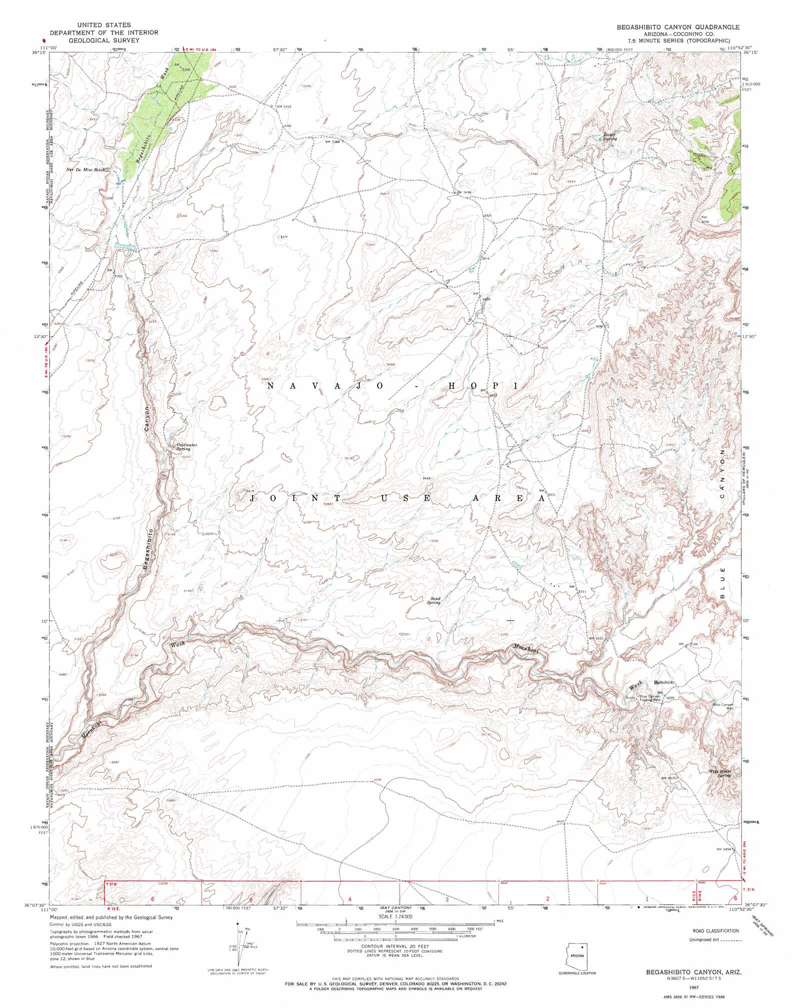
USGS Topo Quad 36110b8 - 1:24,000 scale
| Topo Map Name: | Begashibito Canyon |
| USGS Topo Quad ID: | 36110b8 |
| Print Size: | ca. 21 1/4" wide x 27" high |
| Southeast Coordinates: | 36.125° N latitude / 110.875° W longitude |
| Map Center Coordinates: | 36.1875° N latitude / 110.9375° W longitude |
| U.S. State: | AZ |
| Filename: | o36110b8.jpg |
| Download Map JPG Image: | Begashibito Canyon topo map 1:24,000 scale |
| Map Type: | Topographic |
| Topo Series: | 7.5´ |
| Map Scale: | 1:24,000 |
| Source of Map Images: | United States Geological Survey (USGS) |
| Alternate Map Versions: |
Begashibito Canyon AZ 1967, updated 1969 Download PDF Buy paper map Begashibito Canyon AZ 2011 Download PDF Buy paper map Begashibito Canyon AZ 2014 Download PDF Buy paper map |
1:24,000 Topo Quads surrounding Begashibito Canyon
Preston Mesa North |
Big Whisker Well |
White Mesa Arch |
Cow Springs |
Black Mesa Wash Nw |
Preston Mesa South |
Gopher Spring |
Tonalea |
John Daw Mesa |
Kydestea Spring |
Tuba City |
Middle Mesa |
Begashibito Canyon |
Pillars Of Hercules |
Rocky Ridge Nw |
Moenkopi |
Tuba City Se |
Bat Canyon |
Bat Spring |
Rocky Ridge Sw |
Goldtooth |
Appaloosa Ridge |
Coal Mine Mesa |
Howell Mesa |
Hotevilla |
> Back to 36110a1 at 1:100,000 scale
> Back to 36110a1 at 1:250,000 scale
> Back to U.S. Topo Maps home
Begashibito Canyon topo map: Gazetteer
Begashibito Canyon: Areas
Behihlih elevation 1547m 5075′Begashibito Canyon: Springs
Bitter Spring elevation 1701m 5580′Coldwater Spring elevation 1574m 5164′
Nee De Mise Betoh elevation 1609m 5278′
Sand Spring elevation 0m 0′
Wild Horse Spring elevation 1627m 5337′
Begashibito Canyon: Valleys
Begashibito Wash elevation 1592m 5223′Bitter Spring Wash elevation 1672m 5485′
Blue Canyon elevation 1627m 5337′
Begashibito Canyon: Wells
Blue Canyon Well elevation 1551m 5088′Begashibito Canyon digital topo map on disk
Buy this Begashibito Canyon topo map showing relief, roads, GPS coordinates and other geographical features, as a high-resolution digital map file on DVD: