Shonto Nw Topo Map Arizona
To zoom in, hover over the map of Shonto Nw
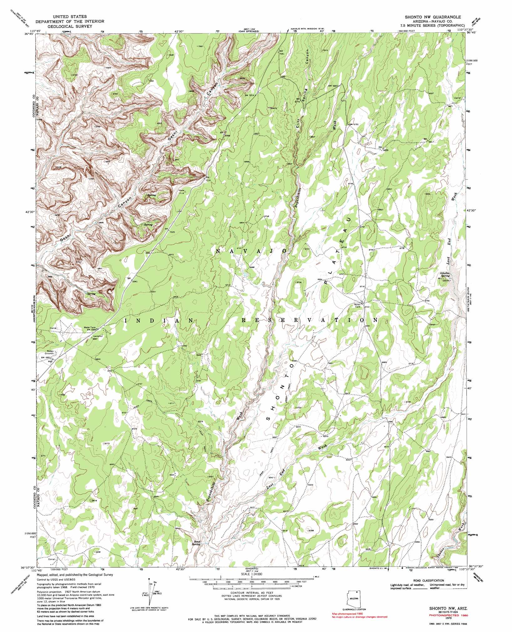
USGS Topo Quad 36110f6 - 1:24,000 scale
| Topo Map Name: | Shonto Nw |
| USGS Topo Quad ID: | 36110f6 |
| Print Size: | ca. 21 1/4" wide x 27" high |
| Southeast Coordinates: | 36.625° N latitude / 110.625° W longitude |
| Map Center Coordinates: | 36.6875° N latitude / 110.6875° W longitude |
| U.S. State: | AZ |
| Filename: | o36110f6.jpg |
| Download Map JPG Image: | Shonto Nw topo map 1:24,000 scale |
| Map Type: | Topographic |
| Topo Series: | 7.5´ |
| Map Scale: | 1:24,000 |
| Source of Map Images: | United States Geological Survey (USGS) |
| Alternate Map Versions: |
Shonto NW AZ 1970, updated 1973 Download PDF Buy paper map Shonto NW AZ 1970, updated 1986 Download PDF Buy paper map Shonto NW AZ 2011 Download PDF Buy paper map Shonto NW AZ 2014 Download PDF Buy paper map |
1:24,000 Topo Quads surrounding Shonto Nw
Chaiyahi Flat |
Chaiyahi Rim Ne |
Tall Mountain Nw |
Cattle Canyon |
Big Point |
Chaiyahi Rim Sw |
Chaiyahi Rim Se |
Oak Springs |
Tall Mountain |
Keet Seel Ruin |
Two Red Mesas |
Inscription House Ruin |
Shonto Nw |
Betatakin Ruin |
Marsh Pass |
Square Butte |
Whirlwind Rock |
Shonto |
Shonto Se |
Long House Valley |
White Mesa Arch |
Cow Springs |
Black Mesa Wash Nw |
Black Mesa Wash Ne |
Great Spring |
> Back to 36110e1 at 1:100,000 scale
> Back to 36110a1 at 1:250,000 scale
> Back to U.S. Topo Maps home
Shonto Nw topo map: Gazetteer
Shonto Nw: Plains
Shonto Plateau elevation 0m 0′Shonto Nw: Springs
Adadka Spring elevation 2037m 6683′Sand Spring elevation 0m 0′
Shonto Nw: Valleys
Cliff Spring Canyon elevation 1995m 6545′Last End Wash elevation 1921m 6302′
Shonto Nw digital topo map on disk
Buy this Shonto Nw topo map showing relief, roads, GPS coordinates and other geographical features, as a high-resolution digital map file on DVD: