Baby Rocks Topo Map Arizona
To zoom in, hover over the map of Baby Rocks
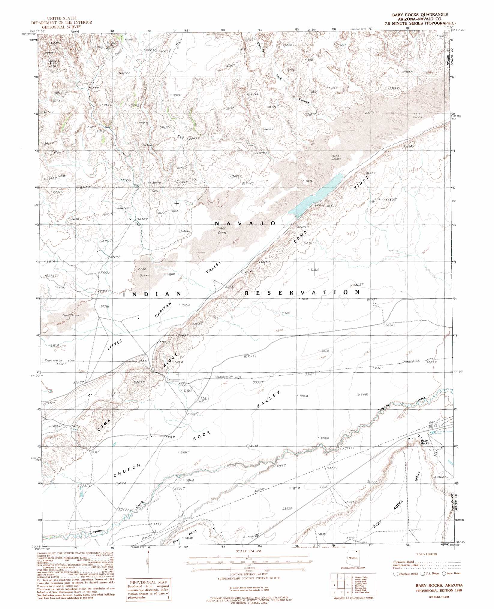
USGS Topo Quad 36110g1 - 1:24,000 scale
| Topo Map Name: | Baby Rocks |
| USGS Topo Quad ID: | 36110g1 |
| Print Size: | ca. 21 1/4" wide x 27" high |
| Southeast Coordinates: | 36.75° N latitude / 110° W longitude |
| Map Center Coordinates: | 36.8125° N latitude / 110.0625° W longitude |
| U.S. State: | AZ |
| Filename: | o36110g1.jpg |
| Download Map JPG Image: | Baby Rocks topo map 1:24,000 scale |
| Map Type: | Topographic |
| Topo Series: | 7.5´ |
| Map Scale: | 1:24,000 |
| Source of Map Images: | United States Geological Survey (USGS) |
| Alternate Map Versions: |
Agathla Peak 1 SE AZ 1952, updated 1954 Download PDF Buy paper map Baby Rocks AZ 1988, updated 1988 Download PDF Buy paper map Baby Rocks AZ 2011 Download PDF Buy paper map Baby Rocks AZ 2014 Download PDF Buy paper map |
1:24,000 Topo Quads surrounding Baby Rocks
Oljeto |
Goulding |
Monument Pass |
Mexican Hat Sw |
Mexican Hat Se |
Boot Mesa |
Mystery Valley |
Mitten Buttes |
Rooster Rock |
Garnet Ridge |
Tseyi-Hatsosi |
Agathla Peak |
Baby Rocks |
Red Point |
Dennehotso |
Kayenta West |
Kayenta East |
Church Rock |
Red Point Mesa |
Tall Mesa |
Marsh Pass Se |
Owl Spring |
Chilchinbito |
Sweetwater Mesa |
White Point |
> Back to 36110e1 at 1:100,000 scale
> Back to 36110a1 at 1:250,000 scale
> Back to U.S. Topo Maps home
Baby Rocks topo map: Gazetteer
Baby Rocks: Arches
Hoola Hey Arch elevation 1703m 5587′Ruin Arch elevation 1832m 6010′
Swinnerton Bridge elevation 1838m 6030′
Baby Rocks: Cliffs
Baby Rocks elevation 1661m 5449′Gray Point elevation 1677m 5501′
Baby Rocks: Lakes
Dry Lake elevation 1622m 5321′Baby Rocks: Populated Places
Baby Rocks elevation 1596m 5236′Baby Rocks: Ridges
Comb Ridge elevation 1705m 5593′Baby Rocks: Valleys
Double Arch Canyon elevation 1646m 5400′Little Capitan Valley elevation 1626m 5334′
Baby Rocks digital topo map on disk
Buy this Baby Rocks topo map showing relief, roads, GPS coordinates and other geographical features, as a high-resolution digital map file on DVD: