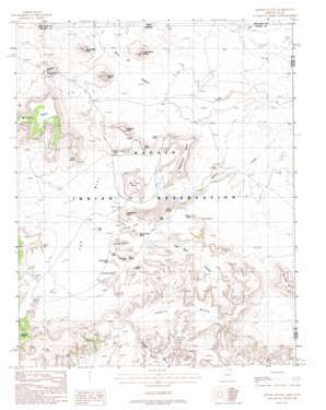
Mitten Buttes Topo Map Arizona
To zoom in, hover over the map of Mitten Buttes
USGS Topo Quad 36110h1 - 1:24,000 scale
| Topo Map Name: | Mitten Buttes |
| USGS Topo Quad ID: | 36110h1 |
| Print Size: | ca. 21 1/4" wide x 27" high |
| Southeast Coordinates: | 36.875° N latitude / 110° W longitude |
| Map Center Coordinates: | 36.9375° N latitude / 110.0625° W longitude |
| U.S. States: | AZ, UT |
| Filename: | o36110h1.jpg |
| Download Map JPG Image: | Mitten Buttes topo map 1:24,000 scale |
| Map Type: | Topographic |
| Topo Series: | 7.5´ |
| Map Scale: | 1:24,000 |
| Source of Map Images: | United States Geological Survey (USGS) |
| Alternate Map Versions: |
Agathla Peak 1 NE AZ 1952, updated 1954 Download PDF Buy paper map Mitten Buttes AZ 1988, updated 1988 Download PDF Buy paper map Mitten Buttes AZ 2011 Download PDF Buy paper map Mitten Buttes AZ 2011 Download PDF Buy paper map Mitten Buttes AZ 2014 Download PDF Buy paper map |
1:24,000 Topo Quads surrounding Mitten Buttes
> Back to 36110e1 at 1:100,000 scale
> Back to 36110a1 at 1:250,000 scale
> Back to U.S. Topo Maps home
Mitten Buttes topo map: Gazetteer
Mitten Buttes: Arches
Big Hogan elevation 1654m 5426′Clara Bernheimer Natural Bridge elevation 1870m 6135′
Donut Arch elevation 1679m 5508′
Ear of the Wind elevation 1674m 5492′
Eye of the Dove elevation 1772m 5813′
Hidden Bridge elevation 1649m 5410′
Moccasin Arch elevation 1649m 5410′
Natural Arch elevation 1854m 6082′
Spiderweb Arch elevation 1817m 5961′
Suns Eye elevation 1669m 5475′
Vreeland Arch elevation 1728m 5669′
Mitten Buttes: Basins
Tse Biyi elevation 1597m 5239′Mitten Buttes: Cliffs
Lookout Point elevation 1710m 5610′Mitten Buttes: Gaps
North Window elevation 1587m 5206′Mitten Buttes: Parks
Monument Valley Navajo Tribal Park elevation 1623m 5324′Mitten Buttes: Pillars
Totem Pole elevation 1705m 5593′Mitten Buttes: Springs
Sand Spring elevation 1560m 5118′Mitten Buttes: Summits
Big Chair elevation 1716m 5629′Camel Butte elevation 1711m 5613′
Cly Butte elevation 1766m 5793′
East Mitten Butte elevation 1705m 5593′
Elephant Butte elevation 1807m 5928′
Hunts Mesa elevation 1940m 6364′
Meridian Butte elevation 1889m 6197′
Merrick Butte elevation 1852m 6076′
Mitchell Mesa elevation 2004m 6574′
Rain God Mesa elevation 1808m 5931′
Spearhead Mesa elevation 1825m 5987′
The Hub elevation 1650m 5413′
Three Sisters elevation 1744m 5721′
Thunderbird Mesa elevation 1684m 5524′
West Mitten Butte elevation 1706m 5597′
Yei Bichei elevation 1623m 5324′
Mitten Buttes digital topo map on disk
Buy this Mitten Buttes topo map showing relief, roads, GPS coordinates and other geographical features, as a high-resolution digital map file on DVD:


