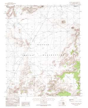
Mystery Valley Topo Map Arizona
To zoom in, hover over the map of Mystery Valley
USGS Topo Quad 36110h2 - 1:24,000 scale
| Topo Map Name: | Mystery Valley |
| USGS Topo Quad ID: | 36110h2 |
| Print Size: | ca. 21 1/4" wide x 27" high |
| Southeast Coordinates: | 36.875° N latitude / 110.125° W longitude |
| Map Center Coordinates: | 36.9375° N latitude / 110.1875° W longitude |
| U.S. States: | AZ, UT |
| Filename: | o36110h2.jpg |
| Download Map JPG Image: | Mystery Valley topo map 1:24,000 scale |
| Map Type: | Topographic |
| Topo Series: | 7.5´ |
| Map Scale: | 1:24,000 |
| Source of Map Images: | United States Geological Survey (USGS) |
| Alternate Map Versions: |
Agathla Peak 1 NW AZ 1952, updated 1954 Download PDF Buy paper map Mystery Valley AZ 1988, updated 1988 Download PDF Buy paper map Mystery Valley AZ 2011 Download PDF Buy paper map Mystery Valley AZ 2011 Download PDF Buy paper map Mystery Valley AZ 2014 Download PDF Buy paper map |
1:24,000 Topo Quads surrounding Mystery Valley
> Back to 36110e1 at 1:100,000 scale
> Back to 36110a1 at 1:250,000 scale
> Back to U.S. Topo Maps home
Mystery Valley topo map: Gazetteer
Mystery Valley: Arches
Eye of the Rabbit elevation 1718m 5636′Four Level Arch elevation 1739m 5705′
Full Moon Arch elevation 1711m 5613′
Honeymoon Arch elevation 1673m 5488′
Natural Arch elevation 1706m 5597′
Pine Tree Arch elevation 1734m 5688′
Square House Natural Arch elevation 1660m 5446′
Stout Arch elevation 1695m 5561′
The Spectacles elevation 1755m 5757′
Mystery Valley: Basins
Mystery Valley elevation 1635m 5364′Mystery Valley: Mines
Monument Number 1 Tunnel elevation 1704m 5590′Monument Number One Annex elevation 1686m 5531′
Mystery Valley: Summits
Gray Whiskers elevation 1802m 5912′Mitchell Butte elevation 1879m 6164′
Wetherill Mesa elevation 1882m 6174′
Mystery Valley: Valleys
Horse Pasture Canyon elevation 1614m 5295′Horse Pasture Canyon elevation 1615m 5298′
Tseya Neechee Canyon elevation 1651m 5416′
Mystery Valley: Wells
Goulding Well elevation 1585m 5200′Mystery Valley digital topo map on disk
Buy this Mystery Valley topo map showing relief, roads, GPS coordinates and other geographical features, as a high-resolution digital map file on DVD:


