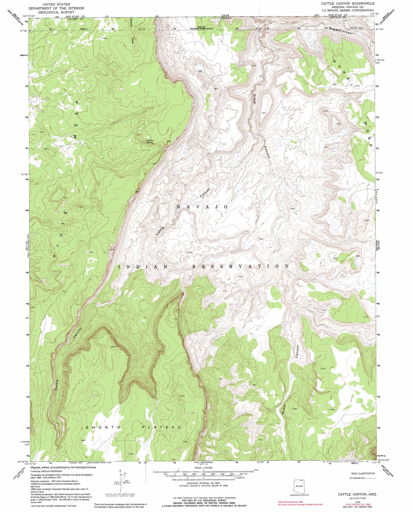
Cattle Canyon Topo Map Arizona
To zoom in, hover over the map of Cattle Canyon
USGS Topo Quad 36110h5 - 1:24,000 scale
| Topo Map Name: | Cattle Canyon |
| USGS Topo Quad ID: | 36110h5 |
| Print Size: | ca. 21 1/4" wide x 27" high |
| Southeast Coordinates: | 36.875° N latitude / 110.5° W longitude |
| Map Center Coordinates: | 36.9375° N latitude / 110.5625° W longitude |
| U.S. State: | AZ |
| Filename: | o36110h5.jpg |
| Download Map JPG Image: | Cattle Canyon topo map 1:24,000 scale |
| Map Type: | Topographic |
| Topo Series: | 7.5´ |
| Map Scale: | 1:24,000 |
| Source of Map Images: | United States Geological Survey (USGS) |
| Alternate Map Versions: |
Shato Spring 1 NE AZ 1952, updated 1954 Download PDF Buy paper map Cattle Canyon AZ 1970, updated 1973 Download PDF Buy paper map Cattle Canyon AZ 1970, updated 1985 Download PDF Buy paper map Cattle Canyon AZ 1970, updated 1991 Download PDF Buy paper map Cattle Canyon AZ 2011 Download PDF Buy paper map Cattle Canyon AZ 2011 Download PDF Buy paper map Cattle Canyon AZ 2014 Download PDF Buy paper map |
1:24,000 Topo Quads surrounding Cattle Canyon
Wilson Creek |
Deep Canyon North |
No Mans Mesa North |
Monitor Butte |
Oljeto Ne |
Navajo Begay |
Deep Canyon South |
No Mans Mesa South |
Jacobs Monument |
Oljeto |
Chaiyahi Rim Ne |
Tall Mountain Nw |
Cattle Canyon |
Big Point |
Boot Mesa |
Chaiyahi Rim Se |
Oak Springs |
Tall Mountain |
Keet Seel Ruin |
Tseyi-Hatsosi |
Inscription House Ruin |
Shonto Nw |
Betatakin Ruin |
Marsh Pass |
Kayenta West |
> Back to 36110e1 at 1:100,000 scale
> Back to 36110a1 at 1:250,000 scale
> Back to U.S. Topo Maps home
Cattle Canyon topo map: Gazetteer
Cattle Canyon: Springs
Fullers Spring elevation 2015m 6610′Cattle Canyon: Valleys
Cattle Canyon elevation 1551m 5088′Cattle Canyon digital topo map on disk
Buy this Cattle Canyon topo map showing relief, roads, GPS coordinates and other geographical features, as a high-resolution digital map file on DVD: