Middle Mesa Topo Map Arizona
To zoom in, hover over the map of Middle Mesa
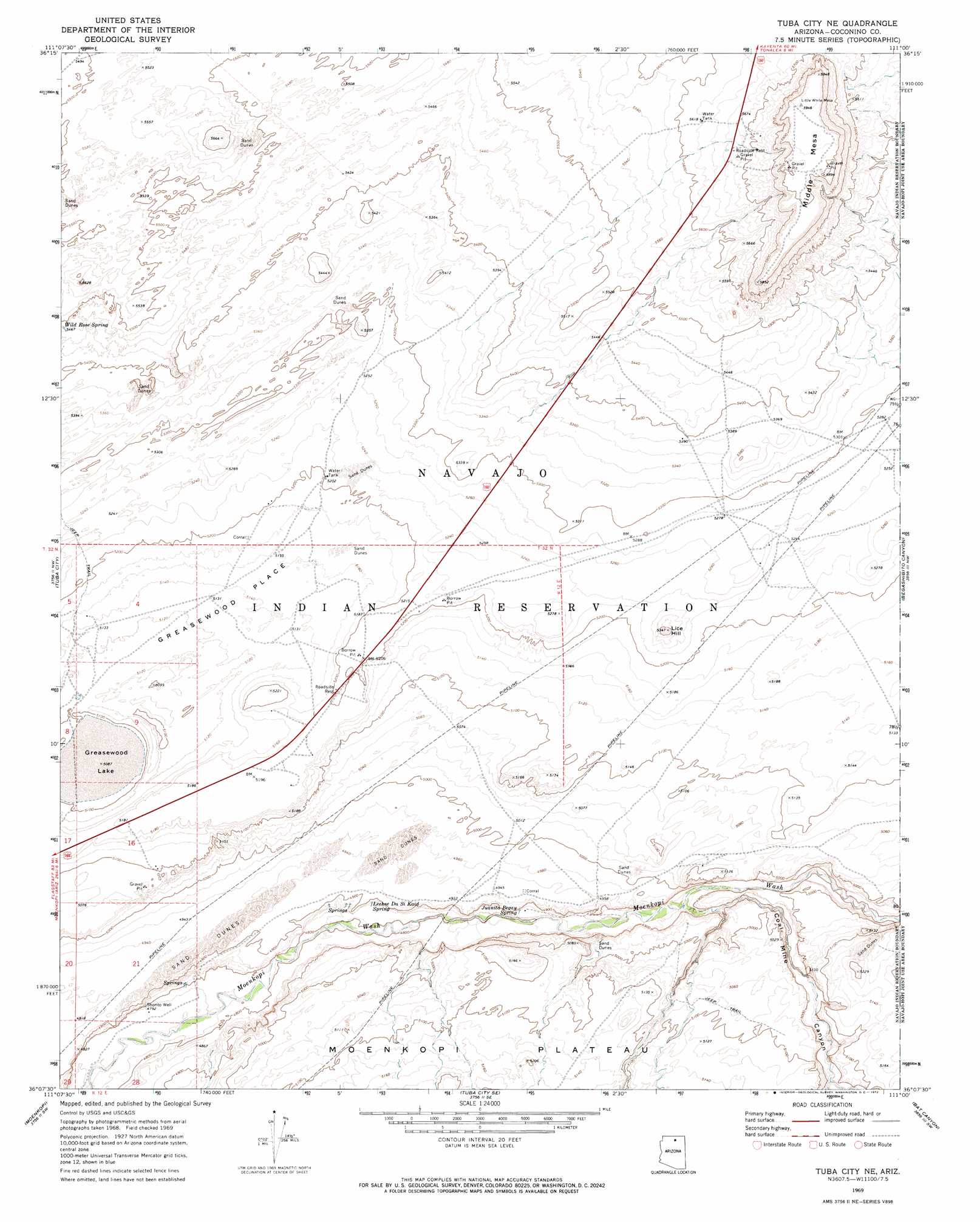
USGS Topo Quad 36111b1 - 1:24,000 scale
| Topo Map Name: | Middle Mesa |
| USGS Topo Quad ID: | 36111b1 |
| Print Size: | ca. 21 1/4" wide x 27" high |
| Southeast Coordinates: | 36.125° N latitude / 111° W longitude |
| Map Center Coordinates: | 36.1875° N latitude / 111.0625° W longitude |
| U.S. State: | AZ |
| Filename: | o36111b1.jpg |
| Download Map JPG Image: | Middle Mesa topo map 1:24,000 scale |
| Map Type: | Topographic |
| Topo Series: | 7.5´ |
| Map Scale: | 1:24,000 |
| Source of Map Images: | United States Geological Survey (USGS) |
| Alternate Map Versions: |
Tuba City NE AZ 1969, updated 1972 Download PDF Buy paper map Middle Mesa AZ 2011 Download PDF Buy paper map Middle Mesa AZ 2014 Download PDF Buy paper map |
1:24,000 Topo Quads surrounding Middle Mesa
Sitting Coyote Hill |
Preston Mesa North |
Big Whisker Well |
White Mesa Arch |
Cow Springs |
Preston Well |
Preston Mesa South |
Gopher Spring |
Tonalea |
John Daw Mesa |
Moenave |
Tuba City |
Middle Mesa |
Begashibito Canyon |
Pillars Of Hercules |
Moenave Se |
Moenkopi |
Tuba City Se |
Bat Canyon |
Bat Spring |
Cameron Ne |
Goldtooth |
Appaloosa Ridge |
Coal Mine Mesa |
Howell Mesa |
> Back to 36111a1 at 1:100,000 scale
> Back to 36110a1 at 1:250,000 scale
> Back to U.S. Topo Maps home
Middle Mesa topo map: Gazetteer
Middle Mesa: Areas
Greasewood Place elevation 1565m 5134′Middle Mesa: Flats
Greasewood Lake elevation 1552m 5091′Middle Mesa: Springs
Juanita Begay Spring elevation 1480m 4855′Lechee Da Si Kaid Spring elevation 1485m 4872′
Middle Mesa: Summits
Lice Hill elevation 1630m 5347′Middle Mesa elevation 1806m 5925′
Middle Mesa: Valleys
Begashibito Canyon elevation 1488m 4881′Coal Mine Canyon elevation 1475m 4839′
Ha Ho No Geh Canyon elevation 1507m 4944′
Middle Mesa: Wells
Shonto Well elevation 0m 0′Middle Mesa digital topo map on disk
Buy this Middle Mesa topo map showing relief, roads, GPS coordinates and other geographical features, as a high-resolution digital map file on DVD: