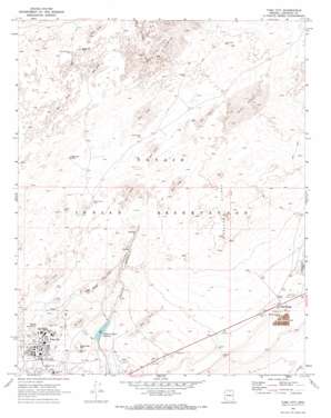
Tuba City Topo Map Arizona
To zoom in, hover over the map of Tuba City
USGS Topo Quad 36111b2 - 1:24,000 scale
| Topo Map Name: | Tuba City |
| USGS Topo Quad ID: | 36111b2 |
| Print Size: | ca. 21 1/4" wide x 27" high |
| Southeast Coordinates: | 36.125° N latitude / 111.125° W longitude |
| Map Center Coordinates: | 36.1875° N latitude / 111.1875° W longitude |
| U.S. State: | AZ |
| Filename: | o36111b2.jpg |
| Download Map JPG Image: | Tuba City topo map 1:24,000 scale |
| Map Type: | Topographic |
| Topo Series: | 7.5´ |
| Map Scale: | 1:24,000 |
| Source of Map Images: | United States Geological Survey (USGS) |
| Alternate Map Versions: |
Tuba City AZ 1969, updated 1972 Download PDF Buy paper map Tuba City AZ 2011 Download PDF Buy paper map Tuba City AZ 2014 Download PDF Buy paper map |
1:24,000 Topo Quads surrounding Tuba City
> Back to 36111a1 at 1:100,000 scale
> Back to 36110a1 at 1:250,000 scale
> Back to U.S. Topo Maps home
Tuba City topo map: Gazetteer
Tuba City: Airports
Tuba City Airport elevation 1508m 4947′Tuba City: Pillars
Standing Rock elevation 1621m 5318′Tuba City: Populated Places
Rare Metals elevation 1577m 5173′Tuba City elevation 1512m 4960′
Tuba City: Reservoirs
Pasture Canyon Reservoir elevation 1489m 4885′Tuba City: Springs
Cottonwood Spring elevation 1604m 5262′Dotson Spring elevation 1542m 5059′
Wild Rose Spring elevation 1669m 5475′
Tuba City: Summits
Castle Buttes elevation 1641m 5383′Castle Rocks elevation 1556m 5104′
Dynamite Hill elevation 1535m 5036′
Tuba City: Wells
Charley Day Well elevation 1525m 5003′Dogwater Well elevation 1610m 5282′
Little Water Well elevation 1635m 5364′
Navajo John Well elevation 1603m 5259′
Rabbit Brush Well elevation 1592m 5223′
Standing Rock Well elevation 1617m 5305′
Tuba City digital topo map on disk
Buy this Tuba City topo map showing relief, roads, GPS coordinates and other geographical features, as a high-resolution digital map file on DVD:


