Preston Mesa South Topo Map Arizona
To zoom in, hover over the map of Preston Mesa South
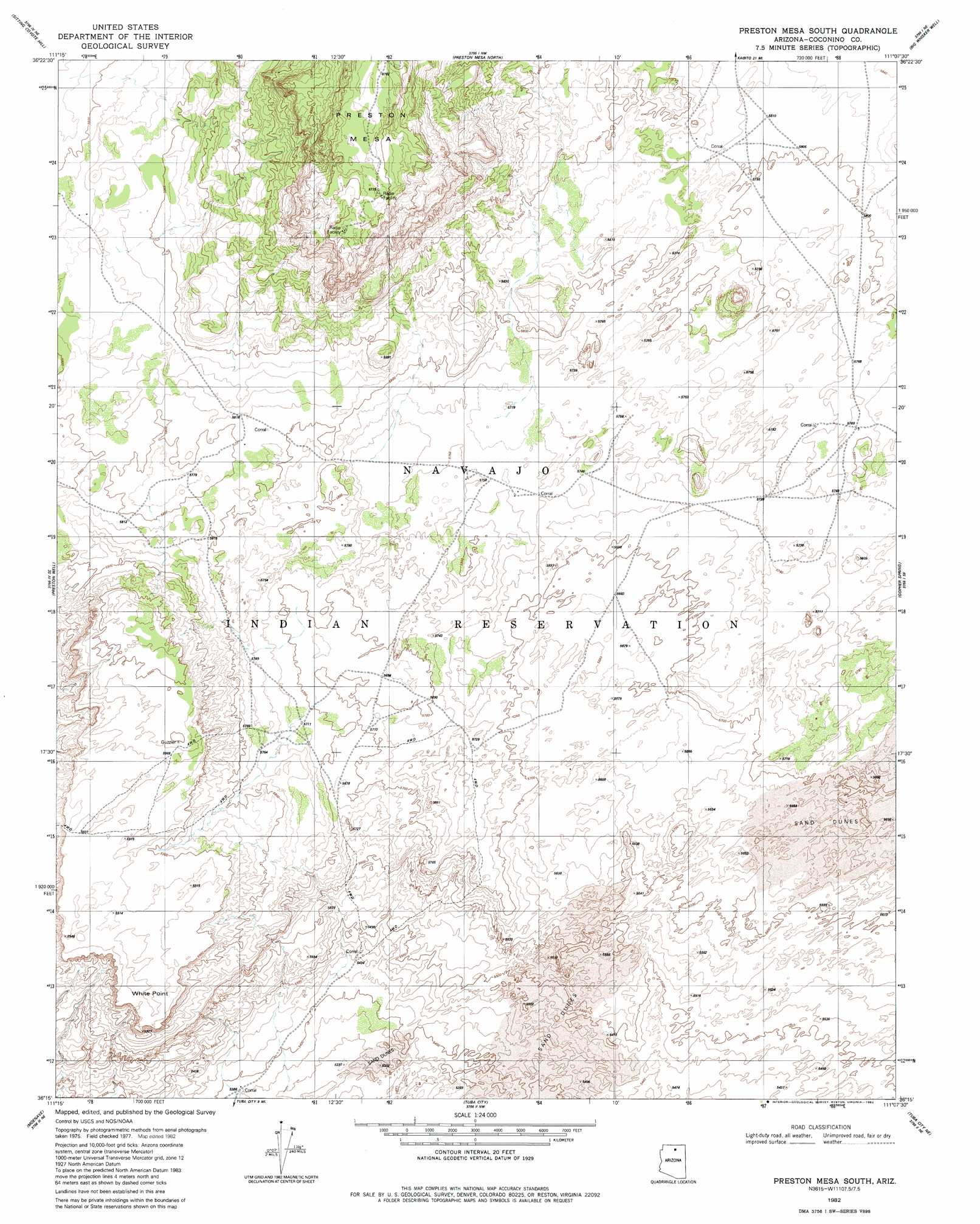
USGS Topo Quad 36111c2 - 1:24,000 scale
| Topo Map Name: | Preston Mesa South |
| USGS Topo Quad ID: | 36111c2 |
| Print Size: | ca. 21 1/4" wide x 27" high |
| Southeast Coordinates: | 36.25° N latitude / 111.125° W longitude |
| Map Center Coordinates: | 36.3125° N latitude / 111.1875° W longitude |
| U.S. State: | AZ |
| Filename: | o36111c2.jpg |
| Download Map JPG Image: | Preston Mesa South topo map 1:24,000 scale |
| Map Type: | Topographic |
| Topo Series: | 7.5´ |
| Map Scale: | 1:24,000 |
| Source of Map Images: | United States Geological Survey (USGS) |
| Alternate Map Versions: |
Preston Mesa South AZ 1982, updated 1982 Download PDF Buy paper map Preston Mesa South AZ 2011 Download PDF Buy paper map Preston Mesa South AZ 2014 Download PDF Buy paper map |
1:24,000 Topo Quads surrounding Preston Mesa South
Dove Spring |
Dove Spring Se |
Arrowhead Mesa |
Kaibito |
Square Butte |
Toh Bih Nosteny |
Sitting Coyote Hill |
Preston Mesa North |
Big Whisker Well |
White Mesa Arch |
The Gap |
Preston Well |
Preston Mesa South |
Gopher Spring |
Tonalea |
Willow Springs |
Moenave |
Tuba City |
Middle Mesa |
Begashibito Canyon |
Shadow Mountain Well |
Moenave Se |
Moenkopi |
Tuba City Se |
Bat Canyon |
> Back to 36111a1 at 1:100,000 scale
> Back to 36110a1 at 1:250,000 scale
> Back to U.S. Topo Maps home
Preston Mesa South topo map: Gazetteer
Preston Mesa South: Cliffs
White Point elevation 1777m 5830′Preston Mesa South: Summits
Preston Mesa elevation 2061m 6761′Preston Mesa South digital topo map on disk
Buy this Preston Mesa South topo map showing relief, roads, GPS coordinates and other geographical features, as a high-resolution digital map file on DVD: