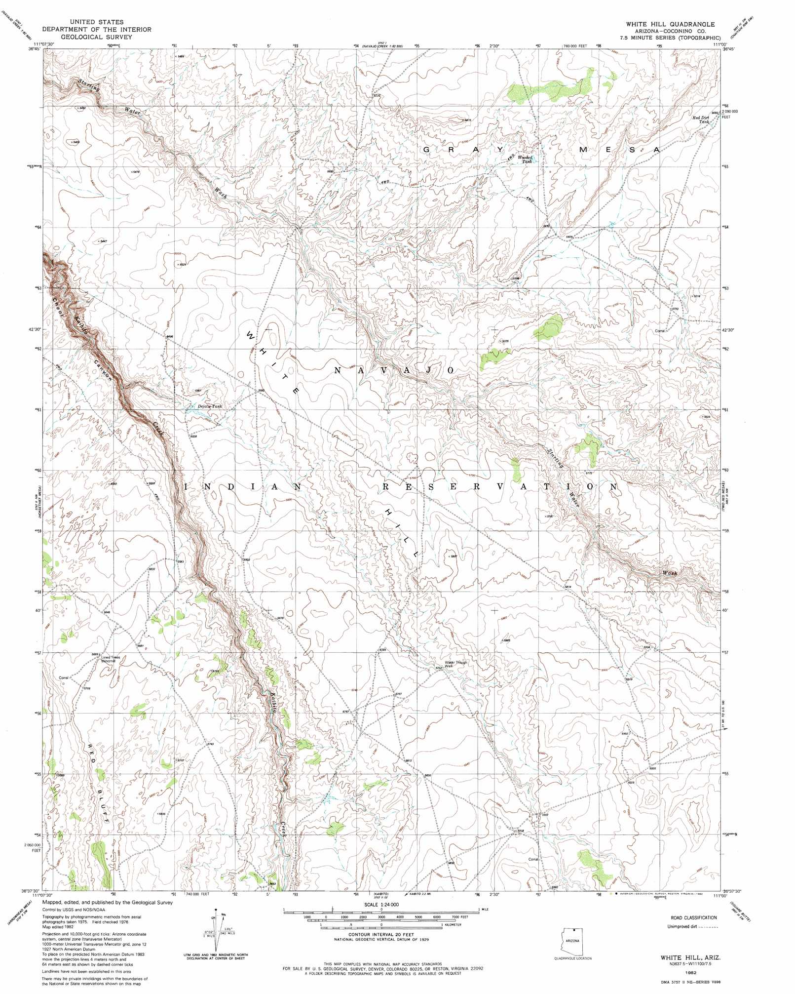
White Hill Topo Map Arizona
To zoom in, hover over the map of White Hill
USGS Topo Quad 36111f1 - 1:24,000 scale
| Topo Map Name: | White Hill |
| USGS Topo Quad ID: | 36111f1 |
| Print Size: | ca. 21 1/4" wide x 27" high |
| Southeast Coordinates: | 36.625° N latitude / 111° W longitude |
| Map Center Coordinates: | 36.6875° N latitude / 111.0625° W longitude |
| U.S. State: | AZ |
| Filename: | o36111f1.jpg |
| Download Map JPG Image: | White Hill topo map 1:24,000 scale |
| Map Type: | Topographic |
| Topo Series: | 7.5´ |
| Map Scale: | 1:24,000 |
| Source of Map Images: | United States Geological Survey (USGS) |
| Alternate Map Versions: |
White Hill AZ 1982, updated 1982 Download PDF Buy paper map White Hill AZ 2011 Download PDF Buy paper map White Hill AZ 2014 Download PDF Buy paper map |
1:24,000 Topo Quads surrounding White Hill
Wild Horse Mesa |
Face Canyon |
West Canyon Creek |
Chaiyahi Flat |
Chaiyahi Rim Ne |
Leche-E Rock |
Cedar Tree Bench |
Tse Esgizii |
Chaiyahi Rim Sw |
Chaiyahi Rim Se |
Many Ghosts Hill |
Horsethief Mesa |
White Hill |
Two Red Mesas |
Inscription House Ruin |
Dove Spring Se |
Arrowhead Mesa |
Kaibito |
Square Butte |
Whirlwind Rock |
Sitting Coyote Hill |
Preston Mesa North |
Big Whisker Well |
White Mesa Arch |
Cow Springs |
> Back to 36111e1 at 1:100,000 scale
> Back to 36110a1 at 1:250,000 scale
> Back to U.S. Topo Maps home
White Hill topo map: Gazetteer
White Hill: Reservoirs
Dejolie Tank elevation 1672m 5485′Red Dirt Tank elevation 1726m 5662′
Wooded Tank elevation 1726m 5662′
White Hill: Wells
Lined Trees Windmill elevation 1736m 5695′Water Trough Well elevation 1750m 5741′
White Hill digital topo map on disk
Buy this White Hill topo map showing relief, roads, GPS coordinates and other geographical features, as a high-resolution digital map file on DVD: