Many Ghosts Hill Topo Map Arizona
To zoom in, hover over the map of Many Ghosts Hill
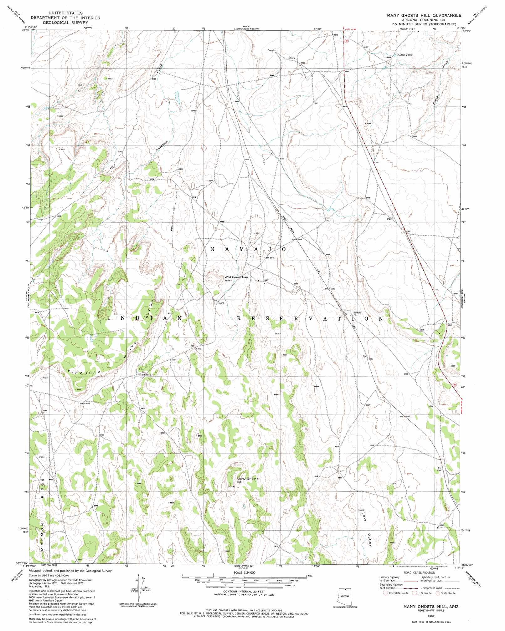
USGS Topo Quad 36111f3 - 1:24,000 scale
| Topo Map Name: | Many Ghosts Hill |
| USGS Topo Quad ID: | 36111f3 |
| Print Size: | ca. 21 1/4" wide x 27" high |
| Southeast Coordinates: | 36.625° N latitude / 111.25° W longitude |
| Map Center Coordinates: | 36.6875° N latitude / 111.3125° W longitude |
| U.S. State: | AZ |
| Filename: | o36111f3.jpg |
| Download Map JPG Image: | Many Ghosts Hill topo map 1:24,000 scale |
| Map Type: | Topographic |
| Topo Series: | 7.5´ |
| Map Scale: | 1:24,000 |
| Source of Map Images: | United States Geological Survey (USGS) |
| Alternate Map Versions: |
Many Ghosts Hill AZ 1982, updated 1982 Download PDF Buy paper map Many Ghosts Hill AZ 2011 Download PDF Buy paper map Many Ghosts Hill AZ 2014 Download PDF Buy paper map |
1:24,000 Topo Quads surrounding Many Ghosts Hill
Ferry Swale |
Page |
Wild Horse Mesa |
Face Canyon |
West Canyon Creek |
Lees Ferry |
White Dome |
Leche-E Rock |
Cedar Tree Bench |
Tse Esgizii |
Explosive Rock |
Dead Monkey Ridge |
Many Ghosts Hill |
Horsethief Mesa |
White Hill |
Cedar Tree Hills |
Dove Spring |
Dove Spring Se |
Arrowhead Mesa |
Kaibito |
Cedar Ridge |
Toh Bih Nosteny |
Sitting Coyote Hill |
Preston Mesa North |
Big Whisker Well |
> Back to 36111e1 at 1:100,000 scale
> Back to 36110a1 at 1:250,000 scale
> Back to U.S. Topo Maps home
Many Ghosts Hill topo map: Gazetteer
Many Ghosts Hill: Basins
Low Valley elevation 1700m 5577′Many Ghosts Hill: Reservoirs
Alkali Tank elevation 1701m 5580′Many Ghosts Hill: Summits
Many Ghosts Hill elevation 1861m 6105′Wild Horse Trap Mesa elevation 1770m 5807′
Many Ghosts Hill digital topo map on disk
Buy this Many Ghosts Hill topo map showing relief, roads, GPS coordinates and other geographical features, as a high-resolution digital map file on DVD: