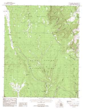
Little Park Lake Topo Map Arizona
To zoom in, hover over the map of Little Park Lake
USGS Topo Quad 36112c1 - 1:24,000 scale
| Topo Map Name: | Little Park Lake |
| USGS Topo Quad ID: | 36112c1 |
| Print Size: | ca. 21 1/4" wide x 27" high |
| Southeast Coordinates: | 36.25° N latitude / 112° W longitude |
| Map Center Coordinates: | 36.3125° N latitude / 112.0625° W longitude |
| U.S. State: | AZ |
| Filename: | o36112c1.jpg |
| Download Map JPG Image: | Little Park Lake topo map 1:24,000 scale |
| Map Type: | Topographic |
| Topo Series: | 7.5´ |
| Map Scale: | 1:24,000 |
| Source of Map Images: | United States Geological Survey (USGS) |
| Alternate Map Versions: |
Little Park Lake AZ 1988, updated 1988 Download PDF Buy paper map Little Park Lake AZ 2012 Download PDF Buy paper map Little Park Lake AZ 2014 Download PDF Buy paper map |
| FStopo: | US Forest Service topo Little Park Lake is available: Download FStopo PDF Download FStopo TIF |
1:24,000 Topo Quads surrounding Little Park Lake
> Back to 36112a1 at 1:100,000 scale
> Back to 36112a1 at 1:250,000 scale
> Back to U.S. Topo Maps home
Little Park Lake topo map: Gazetteer
Little Park Lake: Basins
The Basin elevation 2512m 8241′Little Park Lake: Flats
Lower Little Park elevation 2679m 8789′Upper Little Park elevation 2683m 8802′
Little Park Lake: Lakes
Hades Lake elevation 2574m 8444′Little Park Lake elevation 2679m 8789′
Little Park Lake: Reservoirs
Burn Tank elevation 2682m 8799′Johns Tank elevation 2800m 9186′
Spare Tank elevation 2654m 8707′
Vaughn Tank elevation 2578m 8458′
Little Park Lake: Ridges
Cocks Combs elevation 2152m 7060′Little Park Lake: Springs
Basin Spring elevation 2507m 8225′Neal Spring elevation 2514m 8248′
Robbers Roost Spring elevation 2519m 8264′
South Canyon Spring elevation 2604m 8543′
Upper Thompson Spring elevation 2545m 8349′
Little Park Lake: Summits
Lindbergh Hill elevation 2718m 8917′Little Park Lake: Wells
Mason Well elevation 2669m 8756′Sourdough Well elevation 2694m 8838′
Little Park Lake digital topo map on disk
Buy this Little Park Lake topo map showing relief, roads, GPS coordinates and other geographical features, as a high-resolution digital map file on DVD:


