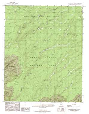
Kanabownits Spring Topo Map Arizona
To zoom in, hover over the map of Kanabownits Spring
USGS Topo Quad 36112c2 - 1:24,000 scale
| Topo Map Name: | Kanabownits Spring |
| USGS Topo Quad ID: | 36112c2 |
| Print Size: | ca. 21 1/4" wide x 27" high |
| Southeast Coordinates: | 36.25° N latitude / 112.125° W longitude |
| Map Center Coordinates: | 36.3125° N latitude / 112.1875° W longitude |
| U.S. State: | AZ |
| Filename: | o36112c2.jpg |
| Download Map JPG Image: | Kanabownits Spring topo map 1:24,000 scale |
| Map Type: | Topographic |
| Topo Series: | 7.5´ |
| Map Scale: | 1:24,000 |
| Source of Map Images: | United States Geological Survey (USGS) |
| Alternate Map Versions: |
Kanabownits Spring AZ 1988, updated 1988 Download PDF Buy paper map Kanabownits Spring AZ 2012 Download PDF Buy paper map Kanabownits Spring AZ 2014 Download PDF Buy paper map |
| FStopo: | US Forest Service topo Kanabownits Spring is available: Download FStopo PDF Download FStopo TIF |
1:24,000 Topo Quads surrounding Kanabownits Spring
> Back to 36112a1 at 1:100,000 scale
> Back to 36112a1 at 1:250,000 scale
> Back to U.S. Topo Maps home
Kanabownits Spring topo map: Gazetteer
Kanabownits Spring: Basins
Shinumo Amphitheater elevation 0m 0′Kanabownits Spring: Cliffs
Bedivere Point elevation 2365m 7759′Kanabownits Spring: Lakes
Bear Lake elevation 2775m 9104′Coffee Lake elevation 2596m 8517′
Wall Lake elevation 2767m 9078′
Kanabownits Spring: Reservoirs
Bear Spring Tank elevation 2664m 8740′South Big Spring Tank elevation 2637m 8651′
Kanabownits Spring: Ridges
Crescent Ridge elevation 2454m 8051′Crystal Ridge elevation 2551m 8369′
Kanabownits Spring: Springs
Bear Spring elevation 2659m 8723′Fawn Spring elevation 2648m 8687′
Kanabownits Spring elevation 2421m 7942′
Tipover Spring elevation 2485m 8152′
Kanabownits Spring: Trails
Point Sublime Trail elevation 2482m 8143′Kanabownits Spring: Valleys
South Fork Big Spring Canyon elevation 2559m 8395′Tipover Canyon elevation 2472m 8110′
Kanabownits Spring digital topo map on disk
Buy this Kanabownits Spring topo map showing relief, roads, GPS coordinates and other geographical features, as a high-resolution digital map file on DVD:


