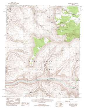
Fishtail Mesa Topo Map Arizona
To zoom in, hover over the map of Fishtail Mesa
USGS Topo Quad 36112d5 - 1:24,000 scale
| Topo Map Name: | Fishtail Mesa |
| USGS Topo Quad ID: | 36112d5 |
| Print Size: | ca. 21 1/4" wide x 27" high |
| Southeast Coordinates: | 36.375° N latitude / 112.5° W longitude |
| Map Center Coordinates: | 36.4375° N latitude / 112.5625° W longitude |
| U.S. State: | AZ |
| Filename: | o36112d5.jpg |
| Download Map JPG Image: | Fishtail Mesa topo map 1:24,000 scale |
| Map Type: | Topographic |
| Topo Series: | 7.5´ |
| Map Scale: | 1:24,000 |
| Source of Map Images: | United States Geological Survey (USGS) |
| Alternate Map Versions: |
Fishtail Mesa AZ 1988, updated 1988 Download PDF Buy paper map Fishtail Mesa AZ 1988, updated 1988 Download PDF Buy paper map Fishtail Mesa AZ 2012 Download PDF Buy paper map Fishtail Mesa AZ 2014 Download PDF Buy paper map |
| FStopo: | US Forest Service topo Fishtail Mesa is available: Download FStopo PDF Download FStopo TIF |
1:24,000 Topo Quads surrounding Fishtail Mesa
> Back to 36112a1 at 1:100,000 scale
> Back to 36112a1 at 1:250,000 scale
> Back to U.S. Topo Maps home
Fishtail Mesa topo map: Gazetteer
Fishtail Mesa: Arches
Keyhole Natural Bridge elevation 1110m 3641′Fishtail Mesa: Benches
Tahuta Terrace elevation 1464m 4803′Fishtail Mesa: Cliffs
Fishtail Point elevation 1727m 5666′Fishtail Mesa: Falls
Deer Creek Falls elevation 596m 1955′Fishtail Mesa: Gaps
Granite Narrows elevation 597m 1958′Little Saddle elevation 1890m 6200′
Fishtail Mesa: Rapids
Doris Rapid elevation 591m 1938′Fishtail Rapids elevation 582m 1909′
Fishtail Mesa: Springs
Deer Spring elevation 886m 2906′Hualapai Spring elevation 1302m 4271′
Indian Hollow Spring elevation 1497m 4911′
Vaughn Spring elevation 1136m 3727′
Fishtail Mesa: Streams
Deer Creek elevation 597m 1958′Fishtail Mesa: Summits
Fishtail Mesa elevation 1820m 5971′Olo Mesa elevation 1368m 4488′
Racetrack Knoll elevation 1422m 4665′
Fishtail Mesa: Valleys
Fishtail Canyon elevation 621m 2037′Hundred and Forty Mile Canyon elevation 643m 2109′
Fishtail Mesa digital topo map on disk
Buy this Fishtail Mesa topo map showing relief, roads, GPS coordinates and other geographical features, as a high-resolution digital map file on DVD:


