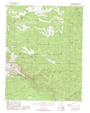
Sowats Spring Topo Map Arizona
To zoom in, hover over the map of Sowats Spring
USGS Topo Quad 36112e4 - 1:24,000 scale
| Topo Map Name: | Sowats Spring |
| USGS Topo Quad ID: | 36112e4 |
| Print Size: | ca. 21 1/4" wide x 27" high |
| Southeast Coordinates: | 36.5° N latitude / 112.375° W longitude |
| Map Center Coordinates: | 36.5625° N latitude / 112.4375° W longitude |
| U.S. State: | AZ |
| Filename: | o36112e4.jpg |
| Download Map JPG Image: | Sowats Spring topo map 1:24,000 scale |
| Map Type: | Topographic |
| Topo Series: | 7.5´ |
| Map Scale: | 1:24,000 |
| Source of Map Images: | United States Geological Survey (USGS) |
| Alternate Map Versions: |
Sowats Spring AZ 1988, updated 1988 Download PDF Buy paper map Sowats Spring AZ 1988, updated 1988 Download PDF Buy paper map Sowats Spring AZ 2012 Download PDF Buy paper map Sowats Spring AZ 2014 Download PDF Buy paper map |
| FStopo: | US Forest Service topo Sowats Spring is available: Download FStopo PDF Download FStopo TIF |
1:24,000 Topo Quads surrounding Sowats Spring
> Back to 36112e1 at 1:100,000 scale
> Back to 36112a1 at 1:250,000 scale
> Back to U.S. Topo Maps home
Sowats Spring topo map: Gazetteer
Sowats Spring: Cliffs
Sawmill Point elevation 0m 0′West Lake Point elevation 2268m 7440′
Sowats Spring: Gaps
Eagle Pass elevation 1944m 6377′Ranger Pass elevation 1916m 6286′
Sowats Spring: Lakes
West Lake elevation 2293m 7522′Sowats Spring: Reservoirs
Bone Hollow Tank elevation 1952m 6404′Pine Flat Tank elevation 2083m 6833′
Pine Hollow Tank elevation 1937m 6354′
Pine Hollow Trick Tank elevation 2072m 6797′
Ranger Pass Trick Tank elevation 1881m 6171′
South Side Tank elevation 1903m 6243′
Sowats Tank elevation 2011m 6597′
White Pockets Tank elevation 1854m 6082′
Sowats Spring: Springs
Box Elder Spring elevation 1580m 5183′Little Sowats Spring elevation 1759m 5770′
Sowats Spring elevation 1852m 6076′
Sowats Spring: Valleys
Big Sowats Canyon elevation 1879m 6164′Little Pine Hollow elevation 1938m 6358′
Little Sowats Canyon elevation 1833m 6013′
Sowats Spring digital topo map on disk
Buy this Sowats Spring topo map showing relief, roads, GPS coordinates and other geographical features, as a high-resolution digital map file on DVD:


