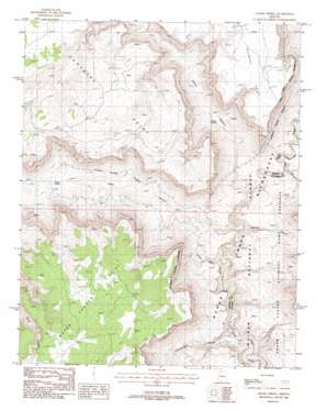
Grama Spring Topo Map Arizona
To zoom in, hover over the map of Grama Spring
USGS Topo Quad 36112e6 - 1:24,000 scale
| Topo Map Name: | Grama Spring |
| USGS Topo Quad ID: | 36112e6 |
| Print Size: | ca. 21 1/4" wide x 27" high |
| Southeast Coordinates: | 36.5° N latitude / 112.625° W longitude |
| Map Center Coordinates: | 36.5625° N latitude / 112.6875° W longitude |
| U.S. State: | AZ |
| Filename: | o36112e6.jpg |
| Download Map JPG Image: | Grama Spring topo map 1:24,000 scale |
| Map Type: | Topographic |
| Topo Series: | 7.5´ |
| Map Scale: | 1:24,000 |
| Source of Map Images: | United States Geological Survey (USGS) |
| Alternate Map Versions: |
Grama Spring AZ 1988, updated 1988 Download PDF Buy paper map Grama Spring AZ 1988, updated 1988 Download PDF Buy paper map Grama Spring AZ 2012 Download PDF Buy paper map Grama Spring AZ 2014 Download PDF Buy paper map |
| FStopo: | US Forest Service topo Grama Spring is available: Download FStopo PDF Download FStopo TIF |
1:24,000 Topo Quads surrounding Grama Spring
> Back to 36112e1 at 1:100,000 scale
> Back to 36112a1 at 1:250,000 scale
> Back to U.S. Topo Maps home
Grama Spring topo map: Gazetteer
Grama Spring: Basins
Water Canyon Catchment elevation 1672m 5485′Grama Spring: Cliffs
Bulrush Point elevation 1610m 5282′Water Canyon Point elevation 1689m 5541′
Grama Spring: Reservoirs
Sunshine Point Catchment elevation 1583m 5193′Grama Spring: Springs
Grama Spring elevation 1158m 3799′Willow Spring elevation 1180m 3871′
Grama Spring: Summits
Sunshine Point elevation 1524m 5000′Grama Spring: Valleys
Big Cove Canyon elevation 1087m 3566′Chamberlain Canyon elevation 963m 3159′
Dinner Pockets Canyon elevation 1072m 3517′
Grama Canyon elevation 1042m 3418′
Hack Canyon elevation 1032m 3385′
Lawson Canyon elevation 1019m 3343′
Grama Spring digital topo map on disk
Buy this Grama Spring topo map showing relief, roads, GPS coordinates and other geographical features, as a high-resolution digital map file on DVD:


