Last Chance Canyon Topo Map Arizona
To zoom in, hover over the map of Last Chance Canyon
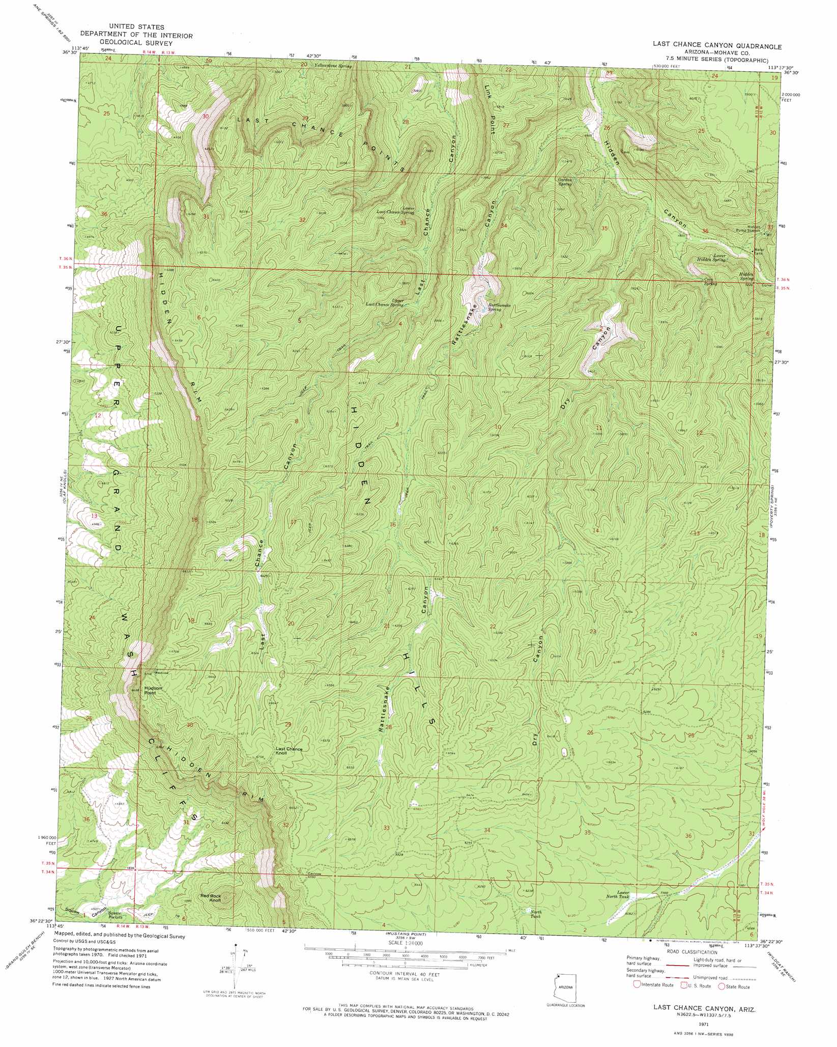
USGS Topo Quad 36113d6 - 1:24,000 scale
| Topo Map Name: | Last Chance Canyon |
| USGS Topo Quad ID: | 36113d6 |
| Print Size: | ca. 21 1/4" wide x 27" high |
| Southeast Coordinates: | 36.375° N latitude / 113.625° W longitude |
| Map Center Coordinates: | 36.4375° N latitude / 113.6875° W longitude |
| U.S. State: | AZ |
| Filename: | o36113d6.jpg |
| Download Map JPG Image: | Last Chance Canyon topo map 1:24,000 scale |
| Map Type: | Topographic |
| Topo Series: | 7.5´ |
| Map Scale: | 1:24,000 |
| Source of Map Images: | United States Geological Survey (USGS) |
| Alternate Map Versions: |
Last Chance Canyon AZ 1971, updated 1974 Download PDF Buy paper map Last Chance Canyon AZ 2011 Download PDF Buy paper map Last Chance Canyon AZ 2014 Download PDF Buy paper map |
1:24,000 Topo Quads surrounding Last Chance Canyon
Jacobs Well |
Cane Springs |
Mustang Knoll |
Sullivan Draw North |
Dutchman Draw |
Red Pockets |
Cane Springs Se |
Saint George Canyon |
Sullivan Draw South |
Little Tanks |
Pakoon Springs |
Olaf Knolls |
Last Chance Canyon |
Poverty Spring |
Poverty Knoll |
Gyp Hills |
Grand Gulch Bench |
Mustang Point |
Wildcat Ranch |
Grassy Mountain |
Snap Canyon West |
Snap Canyon East |
Snap Draw |
Castle Peak |
Yellow John Mountain |
> Back to 36113a1 at 1:100,000 scale
> Back to 36112a1 at 1:250,000 scale
> Back to U.S. Topo Maps home
Last Chance Canyon topo map: Gazetteer
Last Chance Canyon: Cliffs
Hidden Rim elevation 1631m 5351′Hudson Point elevation 2040m 6692′
Last Chance Canyon: Reservoirs
Lower North Tank elevation 1838m 6030′North Tank elevation 1864m 6115′
Squaw Pockets elevation 1367m 4484′
Last Chance Canyon: Springs
Coin Spring elevation 1590m 5216′Gordon Spring elevation 1552m 5091′
Hidden Spring elevation 1564m 5131′
Lower Hidden Spring elevation 1583m 5193′
Lower Last Chance Spring elevation 1553m 5095′
Rattlesnake Spring elevation 1655m 5429′
Upper Last Chance Spring elevation 1617m 5305′
Yellowstone Spring elevation 1403m 4603′
Last Chance Canyon: Summits
Last Chance Knoll elevation 2054m 6738′Last Chance Points elevation 1757m 5764′
Red Rock Knoll elevation 1704m 5590′
Last Chance Canyon: Valleys
Dry Canyon elevation 1469m 4819′Rattlesnake Canyon elevation 1413m 4635′
Last Chance Canyon digital topo map on disk
Buy this Last Chance Canyon topo map showing relief, roads, GPS coordinates and other geographical features, as a high-resolution digital map file on DVD: