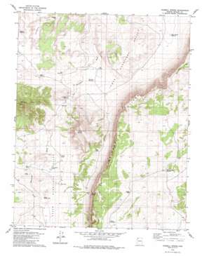
Russell Spring Topo Map Arizona
To zoom in, hover over the map of Russell Spring
USGS Topo Quad 36113e3 - 1:24,000 scale
| Topo Map Name: | Russell Spring |
| USGS Topo Quad ID: | 36113e3 |
| Print Size: | ca. 21 1/4" wide x 27" high |
| Southeast Coordinates: | 36.5° N latitude / 113.25° W longitude |
| Map Center Coordinates: | 36.5625° N latitude / 113.3125° W longitude |
| U.S. State: | AZ |
| Filename: | o36113e3.jpg |
| Download Map JPG Image: | Russell Spring topo map 1:24,000 scale |
| Map Type: | Topographic |
| Topo Series: | 7.5´ |
| Map Scale: | 1:24,000 |
| Source of Map Images: | United States Geological Survey (USGS) |
| Alternate Map Versions: |
Russell Spring AZ 1979, updated 1982 Download PDF Buy paper map Russell Spring AZ 2011 Download PDF Buy paper map Russell Spring AZ 2014 Download PDF Buy paper map |
1:24,000 Topo Quads surrounding Russell Spring
> Back to 36113e1 at 1:100,000 scale
> Back to 36112a1 at 1:250,000 scale
> Back to U.S. Topo Maps home
Russell Spring topo map: Gazetteer
Russell Spring: Dams
Iverson Detention Dam elevation 1530m 5019′Russell Spring: Reservoirs
Big D Reservoir elevation 1491m 4891′Carroll Catchment Tank elevation 1939m 6361′
Chic Pond elevation 1527m 5009′
D-Six Pond elevation 1432m 4698′
Ferg Pond elevation 1531m 5022′
Guaranteed Pond elevation 1513m 4963′
Gyp Reservoir elevation 1463m 4799′
Hidden Tank elevation 1894m 6213′
J W Spendlove Reservoir elevation 1848m 6062′
Keller Pond elevation 1522m 4993′
McCullan Reservoir elevation 1437m 4714′
Salt Pond elevation 1472m 4829′
Sheep Pockets Reservoir elevation 1400m 4593′
Sheep Pockets Trough elevation 1421m 4662′
Sugar Pond elevation 1624m 5328′
Sunshine Tank elevation 1448m 4750′
Woody Pond elevation 1515m 4970′
Russell Spring: Springs
Russell Spring elevation 0m 0′Russell Spring: Summits
Diamond Butte elevation 1848m 6062′Twin Butte elevation 1781m 5843′
Russell Spring: Valleys
Upper Hurricane Valley elevation 1478m 4849′Russell Spring: Wells
Childers Well elevation 1462m 4796′Russell Spring digital topo map on disk
Buy this Russell Spring topo map showing relief, roads, GPS coordinates and other geographical features, as a high-resolution digital map file on DVD:


