Cane Springs Se Topo Map Arizona
To zoom in, hover over the map of Cane Springs Se
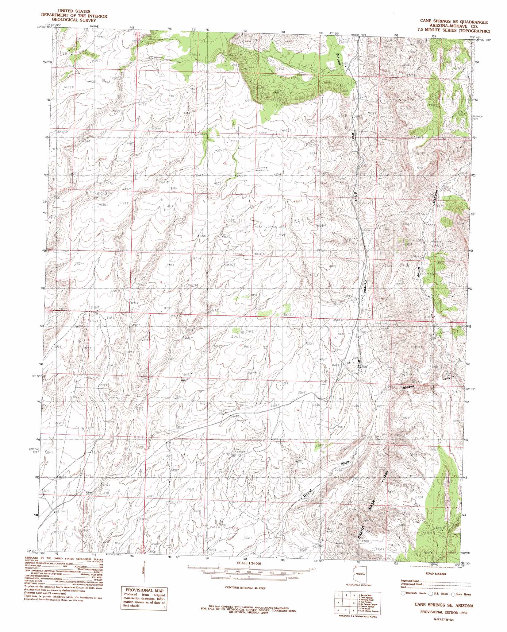
USGS Topo Quad 36113e7 - 1:24,000 scale
| Topo Map Name: | Cane Springs Se |
| USGS Topo Quad ID: | 36113e7 |
| Print Size: | ca. 21 1/4" wide x 27" high |
| Southeast Coordinates: | 36.5° N latitude / 113.75° W longitude |
| Map Center Coordinates: | 36.5625° N latitude / 113.8125° W longitude |
| U.S. State: | AZ |
| Filename: | o36113e7.jpg |
| Download Map JPG Image: | Cane Springs Se topo map 1:24,000 scale |
| Map Type: | Topographic |
| Topo Series: | 7.5´ |
| Map Scale: | 1:24,000 |
| Source of Map Images: | United States Geological Survey (USGS) |
| Alternate Map Versions: |
Littlefield 3 SE AZ 1954, updated 1957 Download PDF Buy paper map Cane Springs SE AZ 1985, updated 1985 Download PDF Buy paper map Cane Springs SE AZ 2011 Download PDF Buy paper map Cane Springs SE AZ 2014 Download PDF Buy paper map |
1:24,000 Topo Quads surrounding Cane Springs Se
Mesquite |
Elbow Canyon |
Mount Bangs |
Wolf Hole Mountain West |
Wolf Hole Mountain East |
Hen Spring |
Jacobs Well |
Cane Springs |
Mustang Knoll |
Sullivan Draw North |
Virgin Peak |
Red Pockets |
Cane Springs Se |
Saint George Canyon |
Sullivan Draw South |
Saint Thomas Gap |
Pakoon Springs |
Olaf Knolls |
Last Chance Canyon |
Poverty Spring |
Azure Ridge |
Gyp Hills |
Grand Gulch Bench |
Mustang Point |
Wildcat Ranch |
> Back to 36113e1 at 1:100,000 scale
> Back to 36112a1 at 1:250,000 scale
> Back to U.S. Topo Maps home
Cane Springs Se topo map: Gazetteer
Cane Springs Se: Valleys
Black Canyon elevation 1050m 3444′Hidden Canyon elevation 987m 3238′
Jump Canyon elevation 1050m 3444′
Pocum Wash elevation 981m 3218′
Cane Springs Se digital topo map on disk
Buy this Cane Springs Se topo map showing relief, roads, GPS coordinates and other geographical features, as a high-resolution digital map file on DVD: