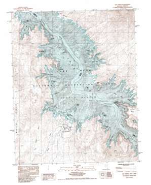
The Temple Topo Map Arizona
To zoom in, hover over the map of The Temple
USGS Topo Quad 36114a3 - 1:24,000 scale
| Topo Map Name: | The Temple |
| USGS Topo Quad ID: | 36114a3 |
| Print Size: | ca. 21 1/4" wide x 27" high |
| Southeast Coordinates: | 36° N latitude / 114.25° W longitude |
| Map Center Coordinates: | 36.0625° N latitude / 114.3125° W longitude |
| U.S. States: | AZ, NV |
| Filename: | o36114a3.jpg |
| Download Map JPG Image: | The Temple topo map 1:24,000 scale |
| Map Type: | Topographic |
| Topo Series: | 7.5´ |
| Map Scale: | 1:24,000 |
| Source of Map Images: | United States Geological Survey (USGS) |
| Alternate Map Versions: |
The Temple NV 1983, updated 1984 Download PDF Buy paper map The Temple NV 2012 Download PDF Buy paper map The Temple NV 2014 Download PDF Buy paper map |
1:24,000 Topo Quads surrounding The Temple
> Back to 36114a1 at 1:100,000 scale
> Back to 36114a1 at 1:250,000 scale
> Back to U.S. Topo Maps home
The Temple topo map: Gazetteer
The Temple: Airports
Temple Bar Airport elevation 460m 1509′The Temple: Bars
Mushroom Reef elevation 367m 1204′Temple Bar elevation 367m 1204′
Temple Bar (historical) elevation 367m 1204′
The Temple: Basins
Temple Basin elevation 367m 1204′Temple Basin elevation 367m 1204′
The Temple: Bays
Delmar Bay elevation 367m 1204′Gateway Cove elevation 367m 1204′
Grebe Bay elevation 367m 1204′
Haystack Bay elevation 367m 1204′
Ladder Cove elevation 369m 1210′
Mesa Cove elevation 367m 1204′
Monkey Cove elevation 367m 1204′
Sawtooth Bay elevation 367m 1204′
Striper Bay elevation 367m 1204′
Teal Coves elevation 367m 1204′
Temple Bay elevation 367m 1204′
Trail Rapids Bay elevation 367m 1204′
Wild Burro Bay elevation 367m 1204′
The Temple: Capes
Boat Wreck Point elevation 376m 1233′The Jawbone elevation 386m 1266′
The Temple: Harbors
Temple Bar Boat Anchorage elevation 377m 1236′Temple Bar Marina elevation 410m 1345′
The Temple: Islands
Decision Island elevation 392m 1286′Heron Point elevation 367m 1204′
Houseboat Island elevation 370m 1213′
Napoleons Tomb elevation 367m 1204′
Plane Crash Island elevation 367m 1204′
The Temple: Pillars
The Campanile elevation 404m 1325′The Temple: Ridges
The Head elevation 397m 1302′The Temple: Streams
Temple Wash elevation 380m 1246′Trail Rapids Wash elevation 378m 1240′
The Temple: Summits
Delmar Butte elevation 469m 1538′The Haystacks elevation 405m 1328′
The Temple elevation 379m 1243′
The Temple: Valleys
Virgin Canyon elevation 367m 1204′The Temple digital topo map on disk
Buy this The Temple topo map showing relief, roads, GPS coordinates and other geographical features, as a high-resolution digital map file on DVD:
Southern Sierra Nevada, California & Southern Nevada
Buy digital topo maps: Southern Sierra Nevada, California & Southern Nevada


