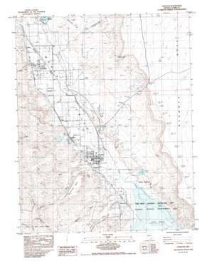
Overton Topo Map Nevada
To zoom in, hover over the map of Overton
USGS Topo Quad 36114e4 - 1:24,000 scale
| Topo Map Name: | Overton |
| USGS Topo Quad ID: | 36114e4 |
| Print Size: | ca. 21 1/4" wide x 27" high |
| Southeast Coordinates: | 36.5° N latitude / 114.375° W longitude |
| Map Center Coordinates: | 36.5625° N latitude / 114.4375° W longitude |
| U.S. State: | NV |
| Filename: | o36114e4.jpg |
| Download Map JPG Image: | Overton topo map 1:24,000 scale |
| Map Type: | Topographic |
| Topo Series: | 7.5´ |
| Map Scale: | 1:24,000 |
| Source of Map Images: | United States Geological Survey (USGS) |
| Alternate Map Versions: |
Overton NV 1983, updated 1984 Download PDF Buy paper map Overton NV 2012 Download PDF Buy paper map Overton NV 2014 Download PDF Buy paper map |
1:24,000 Topo Quads surrounding Overton
> Back to 36114e1 at 1:100,000 scale
> Back to 36114a1 at 1:250,000 scale
> Back to U.S. Topo Maps home
Overton topo map: Gazetteer
Overton: Airports
Overton Municipal Airport elevation 414m 1358′Overton: Dams
Bowman Dam elevation 439m 1440′Honeybee Dam elevation 375m 1230′
Mill Number 1-Pond A Dam elevation 375m 1230′
Mill Number 1-Pond B Dam elevation 376m 1233′
Mill Number 2-Pond A Dam elevation 406m 1332′
Mill Number 2-Pond B Dam elevation 401m 1315′
Mill Number 2-Pond C Dam elevation 401m 1315′
Mill Number 2-Pond D Dam elevation 419m 1374′
Mill Number 2-Pond E Dam elevation 409m 1341′
Overton: Parks
Grant Bowler Park elevation 421m 1381′Lake Mead National Recreation Area elevation 395m 1295′
Lyon Mack Park elevation 389m 1276′
Overton Park elevation 383m 1256′
Overton Pool elevation 388m 1272′
Overton: Populated Places
Amber elevation 437m 1433′Glassand elevation 398m 1305′
Kaolin (historical) elevation 371m 1217′
Logandale elevation 422m 1384′
Moapa Valley elevation 407m 1335′
Old Overton (historical) elevation 404m 1325′
Overton elevation 387m 1269′
Saint Joseph (historical) elevation 412m 1351′
Simonsville (historical) elevation 404m 1325′
Overton: Post Offices
Kaolin Post Office elevation 371m 1217′Logandale Post Office elevation 422m 1384′
Mead Lake Post Office (historical) elevation 378m 1240′
Overton Post Office elevation 385m 1263′
Saint Joseph Post Office elevation 412m 1351′
Overton: Reservoirs
Bowman Reservoir elevation 439m 1440′Honeybee Reservoir elevation 375m 1230′
Overton: Springs
Swamp Spring elevation 375m 1230′Overton: Streams
Kaolin Wash elevation 380m 1246′Logan Wash elevation 425m 1394′
Magnesite Wash elevation 375m 1230′
Overton Wash elevation 378m 1240′
Wieber Wash elevation 407m 1335′
Overton: Summits
Mormon Mesa elevation 577m 1893′Overton Mesa elevation 487m 1597′
Overton: Valleys
Moapa Valley elevation 375m 1230′Overton digital topo map on disk
Buy this Overton topo map showing relief, roads, GPS coordinates and other geographical features, as a high-resolution digital map file on DVD:
Southern Sierra Nevada, California & Southern Nevada
Buy digital topo maps: Southern Sierra Nevada, California & Southern Nevada


