Arrow Canyon Sw Topo Map Nevada
To zoom in, hover over the map of Arrow Canyon Sw
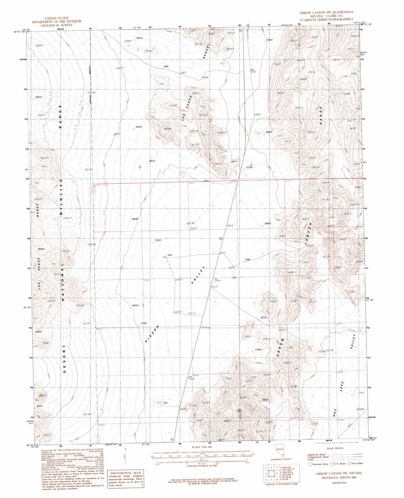
USGS Topo Quad 36114e8 - 1:24,000 scale
| Topo Map Name: | Arrow Canyon Sw |
| USGS Topo Quad ID: | 36114e8 |
| Print Size: | ca. 21 1/4" wide x 27" high |
| Southeast Coordinates: | 36.5° N latitude / 114.875° W longitude |
| Map Center Coordinates: | 36.5625° N latitude / 114.9375° W longitude |
| U.S. State: | NV |
| Filename: | o36114e8.jpg |
| Download Map JPG Image: | Arrow Canyon Sw topo map 1:24,000 scale |
| Map Type: | Topographic |
| Topo Series: | 7.5´ |
| Map Scale: | 1:24,000 |
| Source of Map Images: | United States Geological Survey (USGS) |
| Alternate Map Versions: |
Arrow Canyon SW NV 1986, updated 1986 Download PDF Buy paper map Arrow Canyon SW NV 2012 Download PDF Buy paper map Arrow Canyon SW NV 2015 Download PDF Buy paper map |
1:24,000 Topo Quads surrounding Arrow Canyon Sw
Mule Deer Ridge |
Mule Deer Ridge Se |
Wildcat Wash Sw |
Wildcat Wash Se |
Farrier |
Hayford Peak |
Mormon Well |
Arrow Canyon Nw |
Arrow Canyon |
Moapa West |
Sheep Peak |
Hayford Peak Se |
Arrow Canyon Sw |
Arrow Canyon Se |
Ute |
Gass Peak |
Gass Peak Ne |
Dry Lake Nw |
Dry Lake |
Piute Point |
Gass Peak Sw |
Valley |
Apex |
Dry Lake Se |
Muddy Peak |
> Back to 36114e1 at 1:100,000 scale
> Back to 36114a1 at 1:250,000 scale
> Back to U.S. Topo Maps home
Arrow Canyon Sw topo map: Gazetteer
Arrow Canyon Sw: Basins
Hidden Valley elevation 814m 2670′Arrow Canyon Sw: Flats
Dry Lake elevation 809m 2654′Arrow Canyon Sw digital topo map on disk
Buy this Arrow Canyon Sw topo map showing relief, roads, GPS coordinates and other geographical features, as a high-resolution digital map file on DVD:
Southern Sierra Nevada, California & Southern Nevada
Buy digital topo maps: Southern Sierra Nevada, California & Southern Nevada