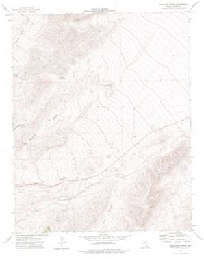
Grapevine Spring Topo Map Nevada
To zoom in, hover over the map of Grapevine Spring
USGS Topo Quad 36115c4 - 1:24,000 scale
| Topo Map Name: | Grapevine Spring |
| USGS Topo Quad ID: | 36115c4 |
| Print Size: | ca. 21 1/4" wide x 27" high |
| Southeast Coordinates: | 36.25° N latitude / 115.375° W longitude |
| Map Center Coordinates: | 36.3125° N latitude / 115.4375° W longitude |
| U.S. State: | NV |
| Filename: | o36115c4.jpg |
| Download Map JPG Image: | Grapevine Spring topo map 1:24,000 scale |
| Map Type: | Topographic |
| Topo Series: | 7.5´ |
| Map Scale: | 1:24,000 |
| Source of Map Images: | United States Geological Survey (USGS) |
| Alternate Map Versions: |
Grapevine Spring NV 1974, updated 1977 Download PDF Buy paper map |
1:24,000 Topo Quads surrounding Grapevine Spring
> Back to 36115a1 at 1:100,000 scale
> Back to 36114a1 at 1:250,000 scale
> Back to U.S. Topo Maps home
Grapevine Spring topo map: Gazetteer
Grapevine Spring: Flats
Deer Pasture elevation 1409m 4622′Grapevine Spring: Springs
Grapevine Spring elevation 1500m 4921′Grassy Spring elevation 1568m 5144′
Shoemaker Spring elevation 1541m 5055′
Grapevine Spring: Valleys
Goodwater Canyon elevation 1469m 4819′Grapevine Canyon elevation 1556m 5104′
Grassy Canyon elevation 1252m 4107′
Harris Springs Canyon elevation 1109m 3638′
Kyle Canyon elevation 1331m 4366′
Grapevine Spring digital topo map on disk
Buy this Grapevine Spring topo map showing relief, roads, GPS coordinates and other geographical features, as a high-resolution digital map file on DVD:
Southern Sierra Nevada, California & Southern Nevada
Buy digital topo maps: Southern Sierra Nevada, California & Southern Nevada


