Gass Peak Ne Topo Map Nevada
To zoom in, hover over the map of Gass Peak Ne
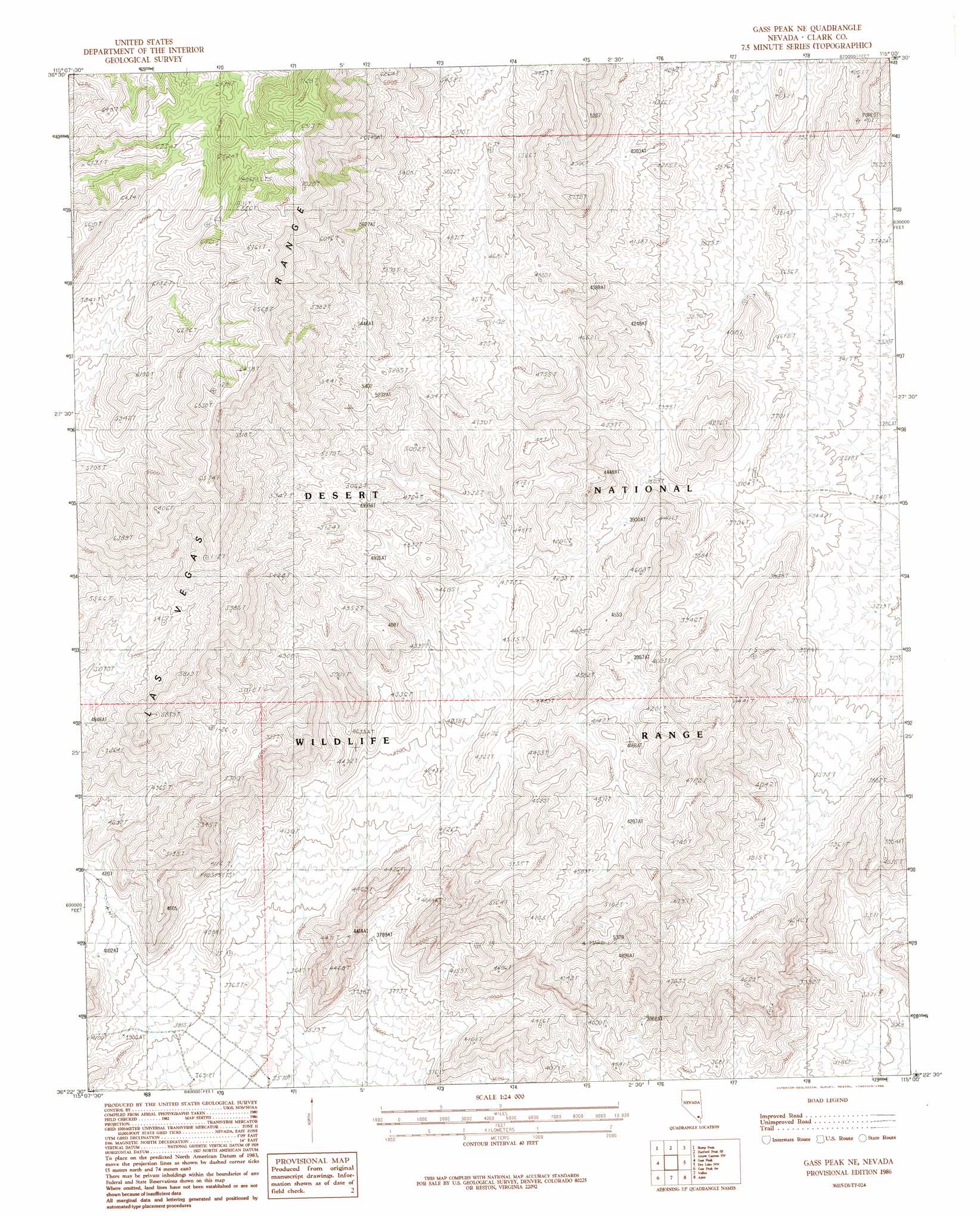
USGS Topo Quad 36115d1 - 1:24,000 scale
| Topo Map Name: | Gass Peak Ne |
| USGS Topo Quad ID: | 36115d1 |
| Print Size: | ca. 21 1/4" wide x 27" high |
| Southeast Coordinates: | 36.375° N latitude / 115° W longitude |
| Map Center Coordinates: | 36.4375° N latitude / 115.0625° W longitude |
| U.S. State: | NV |
| Filename: | o36115d1.jpg |
| Download Map JPG Image: | Gass Peak Ne topo map 1:24,000 scale |
| Map Type: | Topographic |
| Topo Series: | 7.5´ |
| Map Scale: | 1:24,000 |
| Source of Map Images: | United States Geological Survey (USGS) |
| Alternate Map Versions: |
Gass Peak NE NV 1986, updated 1986 Download PDF Buy paper map Gass Peak NE NV 2012 Download PDF Buy paper map Gass Peak NE NV 2014 Download PDF Buy paper map |
1:24,000 Topo Quads surrounding Gass Peak Ne
White Sage Flat |
Hayford Peak |
Mormon Well |
Arrow Canyon Nw |
Arrow Canyon |
Black Hills |
Sheep Peak |
Hayford Peak Se |
Arrow Canyon Sw |
Arrow Canyon Se |
Corn Creek Springs |
Gass Peak |
Gass Peak Ne |
Dry Lake Nw |
Dry Lake |
Tule Springs Park |
Gass Peak Sw |
Valley |
Apex |
Dry Lake Se |
Blue Diamond Ne |
Las Vegas Nw |
Las Vegas Ne |
Frenchman Mountain |
Government Wash |
> Back to 36115a1 at 1:100,000 scale
> Back to 36114a1 at 1:250,000 scale
> Back to U.S. Topo Maps home
No gazetteer data is available for the Gass Peak Ne topo map sheet.
Gass Peak Ne digital topo map on disk
Buy this Gass Peak Ne topo map showing relief, roads, GPS coordinates and other geographical features, as a high-resolution digital map file on DVD:
Southern Sierra Nevada, California & Southern Nevada
Buy digital topo maps: Southern Sierra Nevada, California & Southern Nevada