Corn Creek Springs Nw Topo Map Nevada
To zoom in, hover over the map of Corn Creek Springs Nw
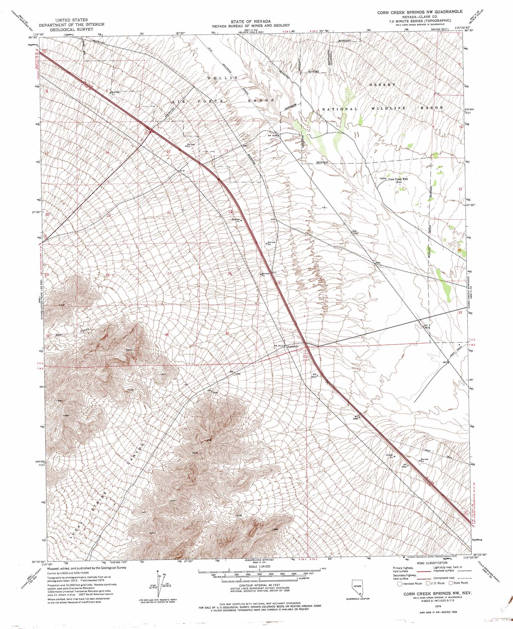
USGS Topo Quad 36115d4 - 1:24,000 scale
| Topo Map Name: | Corn Creek Springs Nw |
| USGS Topo Quad ID: | 36115d4 |
| Print Size: | ca. 21 1/4" wide x 27" high |
| Southeast Coordinates: | 36.375° N latitude / 115.375° W longitude |
| Map Center Coordinates: | 36.4375° N latitude / 115.4375° W longitude |
| U.S. State: | NV |
| Filename: | o36115d4.jpg |
| Download Map JPG Image: | Corn Creek Springs Nw topo map 1:24,000 scale |
| Map Type: | Topographic |
| Topo Series: | 7.5´ |
| Map Scale: | 1:24,000 |
| Source of Map Images: | United States Geological Survey (USGS) |
| Alternate Map Versions: |
Corn Creek Springs NW NV 1974, updated 1977 Download PDF Buy paper map Corn Creek Springs NW NV 1974, updated 1977 Download PDF Buy paper map |
1:24,000 Topo Quads surrounding Corn Creek Springs Nw
Indian Springs Nw |
Heavens Well |
Black Hills Nw |
White Sage Flat |
Hayford Peak |
Indian Springs |
Indian Springs Se |
Black Hills Sw |
Black Hills |
Sheep Peak |
Cold Creek |
Charleston Peak Ne |
Corn Creek Springs Nw |
Corn Creek Springs |
Gass Peak |
Charleston Peak |
Angel Peak |
Grapevine Spring |
Tule Springs Park |
Gass Peak Sw |
Griffith Peak |
La Madre Spring |
La Madre Mountain |
Blue Diamond Ne |
Las Vegas Nw |
> Back to 36115a1 at 1:100,000 scale
> Back to 36114a1 at 1:250,000 scale
> Back to U.S. Topo Maps home
Corn Creek Springs Nw topo map: Gazetteer
Corn Creek Springs Nw: Populated Places
Corn Creek (historical) elevation 870m 2854′Corn Creek Springs Nw: Streams
Deer Creek elevation 1160m 3805′Corn Creek Springs Nw: Valleys
Lucky Strike Canyon elevation 1065m 3494′Corn Creek Springs Nw digital topo map on disk
Buy this Corn Creek Springs Nw topo map showing relief, roads, GPS coordinates and other geographical features, as a high-resolution digital map file on DVD:
Southern Sierra Nevada, California & Southern Nevada
Buy digital topo maps: Southern Sierra Nevada, California & Southern Nevada