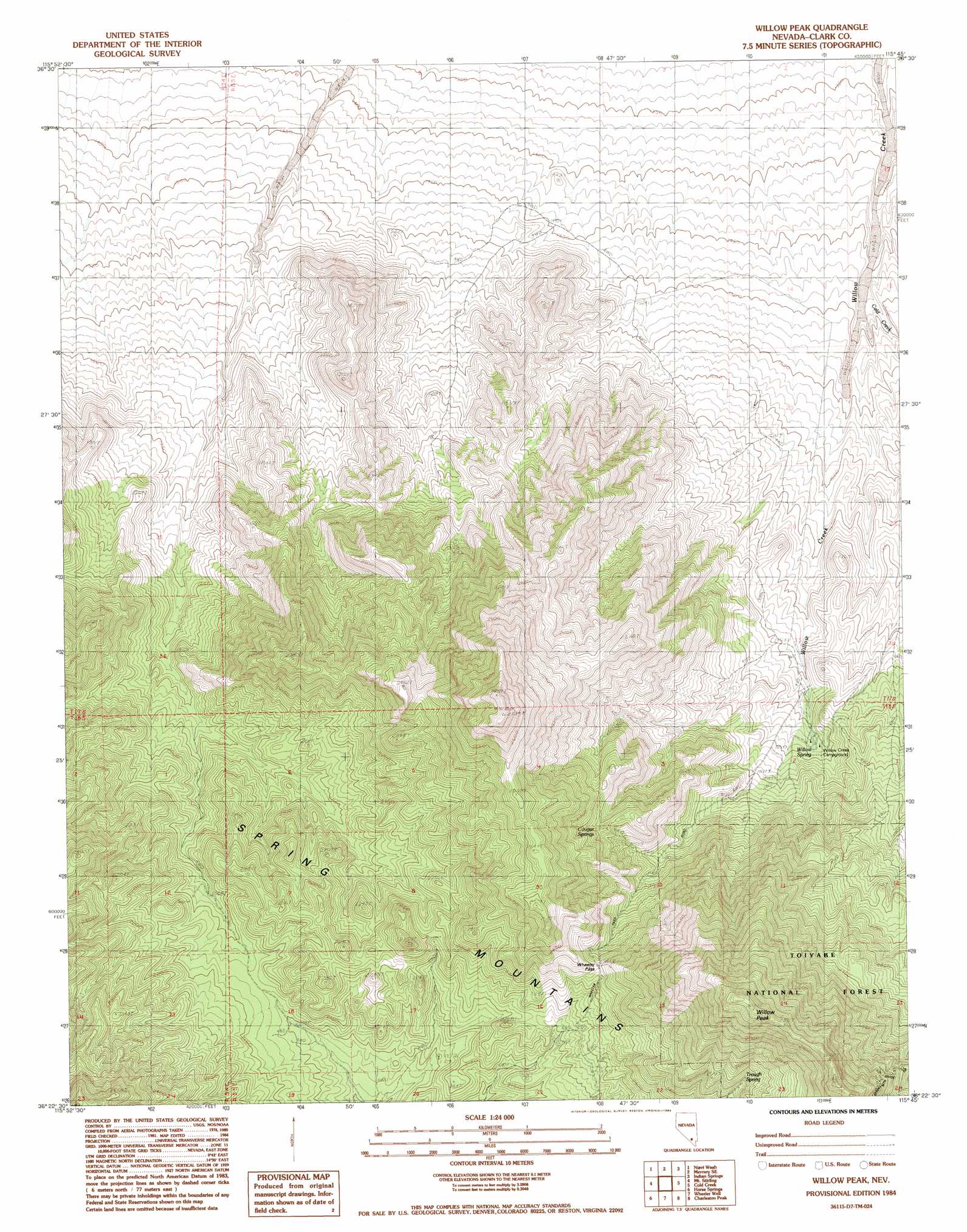
Willow Peak Topo Map Nevada
To zoom in, hover over the map of Willow Peak
USGS Topo Quad 36115d7 - 1:24,000 scale
| Topo Map Name: | Willow Peak |
| USGS Topo Quad ID: | 36115d7 |
| Print Size: | ca. 21 1/4" wide x 27" high |
| Southeast Coordinates: | 36.375° N latitude / 115.75° W longitude |
| Map Center Coordinates: | 36.4375° N latitude / 115.8125° W longitude |
| U.S. State: | NV |
| Filename: | o36115d7.jpg |
| Download Map JPG Image: | Willow Peak topo map 1:24,000 scale |
| Map Type: | Topographic |
| Topo Series: | 7.5´ |
| Map Scale: | 1:24,000 |
| Source of Map Images: | United States Geological Survey (USGS) |
| Alternate Map Versions: |
Willow Peak NV 1984, updated 1984 Download PDF Buy paper map Willow Peak NV 2012 Download PDF Buy paper map Willow Peak NV 2014 Download PDF Buy paper map |
| FStopo: | US Forest Service topo Willow Peak is available: Download FStopo PDF Download FStopo TIF |
1:24,000 Topo Quads surrounding Willow Peak
Camp Desert Rock |
Mercury |
Mercury Ne |
Indian Springs Nw |
Heavens Well |
Point Of Rocks |
Niavi Wash |
Mercury Se |
Indian Springs |
Indian Springs Se |
Mount Schader |
Mount Stirling |
Willow Peak |
Cold Creek |
Charleston Peak Ne |
Last Chance Range |
Horse Springs |
Wheeler Well |
Charleston Peak |
Angel Peak |
Sixmile Spring |
Pahrump |
Pahrump Ne |
Griffith Peak |
La Madre Spring |
> Back to 36115a1 at 1:100,000 scale
> Back to 36114a1 at 1:250,000 scale
> Back to U.S. Topo Maps home
Willow Peak topo map: Gazetteer
Willow Peak: Gaps
Wheeler Pass elevation 2339m 7673′Willow Peak: Springs
Cougar Springs elevation 2220m 7283′Oak Spring elevation 2381m 7811′
Trough Spring elevation 2492m 8175′
Willow Spring elevation 1821m 5974′
Willow Peak: Streams
Cold Creek elevation 1464m 4803′Willow Peak: Summits
Willow Peak elevation 3025m 9924′Willow Peak: Valleys
Willow Canyon elevation 1750m 5741′Willow Peak digital topo map on disk
Buy this Willow Peak topo map showing relief, roads, GPS coordinates and other geographical features, as a high-resolution digital map file on DVD:
Southern Sierra Nevada, California & Southern Nevada
Buy digital topo maps: Southern Sierra Nevada, California & Southern Nevada