Indian Springs Topo Map Nevada
To zoom in, hover over the map of Indian Springs
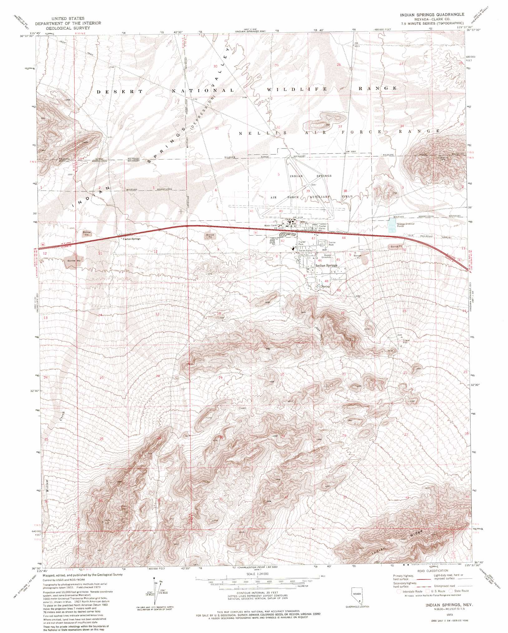
USGS Topo Quad 36115e6 - 1:24,000 scale
| Topo Map Name: | Indian Springs |
| USGS Topo Quad ID: | 36115e6 |
| Print Size: | ca. 21 1/4" wide x 27" high |
| Southeast Coordinates: | 36.5° N latitude / 115.625° W longitude |
| Map Center Coordinates: | 36.5625° N latitude / 115.6875° W longitude |
| U.S. State: | NV |
| Filename: | o36115e6.jpg |
| Download Map JPG Image: | Indian Springs topo map 1:24,000 scale |
| Map Type: | Topographic |
| Topo Series: | 7.5´ |
| Map Scale: | 1:24,000 |
| Source of Map Images: | United States Geological Survey (USGS) |
| Alternate Map Versions: |
Indian Springs NV 1973, updated 1977 Download PDF Buy paper map Indian Springs NV 1973, updated 1984 Download PDF Buy paper map |
1:24,000 Topo Quads surrounding Indian Springs
Frenchman Lake |
Frenchman Lake Se |
Quartz Peak Sw |
Tim Spring |
Dog Bone Lake South |
Mercury |
Mercury Ne |
Indian Springs Nw |
Heavens Well |
Black Hills Nw |
Niavi Wash |
Mercury Se |
Indian Springs |
Indian Springs Se |
Black Hills Sw |
Mount Stirling |
Willow Peak |
Cold Creek |
Charleston Peak Ne |
Corn Creek Springs Nw |
Horse Springs |
Wheeler Well |
Charleston Peak |
Angel Peak |
Grapevine Spring |
> Back to 36115e1 at 1:100,000 scale
> Back to 36114a1 at 1:250,000 scale
> Back to U.S. Topo Maps home
Indian Springs topo map: Gazetteer
Indian Springs: Parks
Indian Springs Park elevation 963m 3159′Indian Springs Pool elevation 963m 3159′
Indian Springs: Populated Places
Cactus Springs elevation 985m 3231′Indian Springs elevation 966m 3169′
Indian Springs: Post Offices
Indian Springs Post Office elevation 966m 3169′Indian Springs: Ridges
Indian Ridge elevation 1447m 4747′Indian Springs: Springs
Indian Spring elevation 971m 3185′Mesquite Spring elevation 988m 3241′
Indian Springs: Streams
Willow Creek elevation 990m 3248′Indian Springs digital topo map on disk
Buy this Indian Springs topo map showing relief, roads, GPS coordinates and other geographical features, as a high-resolution digital map file on DVD:
Southern Sierra Nevada, California & Southern Nevada
Buy digital topo maps: Southern Sierra Nevada, California & Southern Nevada