White Sage Flat Topo Map Nevada
To zoom in, hover over the map of White Sage Flat
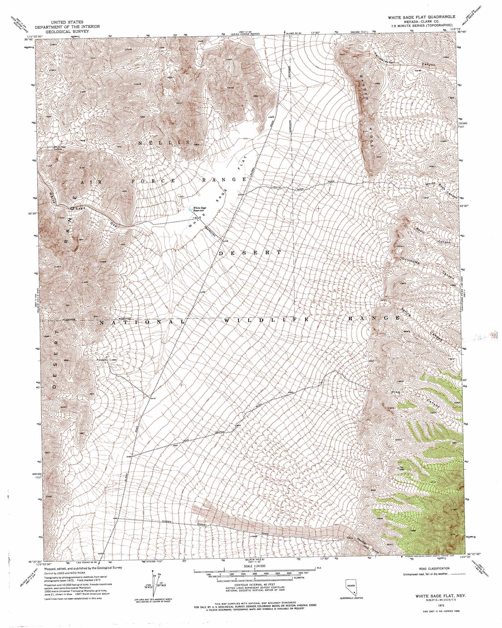
USGS Topo Quad 36115f3 - 1:24,000 scale
| Topo Map Name: | White Sage Flat |
| USGS Topo Quad ID: | 36115f3 |
| Print Size: | ca. 21 1/4" wide x 27" high |
| Southeast Coordinates: | 36.625° N latitude / 115.25° W longitude |
| Map Center Coordinates: | 36.6875° N latitude / 115.3125° W longitude |
| U.S. State: | NV |
| Filename: | o36115f3.jpg |
| Download Map JPG Image: | White Sage Flat topo map 1:24,000 scale |
| Map Type: | Topographic |
| Topo Series: | 7.5´ |
| Map Scale: | 1:24,000 |
| Source of Map Images: | United States Geological Survey (USGS) |
| Alternate Map Versions: |
White Sage Flat NV 1973, updated 1976 Download PDF Buy paper map |
1:24,000 Topo Quads surrounding White Sage Flat
Quartz Peak |
Dog Bone Lake North |
Burro Basin |
Mule Deer Ridge Nw |
Mule Deer Ridge Ne |
Tim Spring |
Dog Bone Lake South |
Dead Horse Ridge |
Mule Deer Ridge |
Mule Deer Ridge Se |
Heavens Well |
Black Hills Nw |
White Sage Flat |
Hayford Peak |
Mormon Well |
Indian Springs Se |
Black Hills Sw |
Black Hills |
Sheep Peak |
Hayford Peak Se |
Charleston Peak Ne |
Corn Creek Springs Nw |
Corn Creek Springs |
Gass Peak |
Gass Peak Ne |
> Back to 36115e1 at 1:100,000 scale
> Back to 36114a1 at 1:250,000 scale
> Back to U.S. Topo Maps home
White Sage Flat topo map: Gazetteer
White Sage Flat: Flats
White Sage Flat elevation 1281m 4202′White Sage Flat: Reservoirs
White Sage Guzzler elevation 1266m 4153′White Sage Reservoir elevation 1274m 4179′
White Sage Flat: Ridges
Banded Ridge elevation 1497m 4911′White Sage Flat: Valleys
Basin Canyon elevation 1593m 5226′Deadman Canyon elevation 1787m 5862′
Pine Canyon elevation 1668m 5472′
Quijinump Canyon elevation 1617m 5305′
Spring Canyon elevation 1615m 5298′
White Rock Canyon elevation 1580m 5183′
Yellowjacket Canyon elevation 1394m 4573′
White Sage Flat digital topo map on disk
Buy this White Sage Flat topo map showing relief, roads, GPS coordinates and other geographical features, as a high-resolution digital map file on DVD:
Southern Sierra Nevada, California & Southern Nevada
Buy digital topo maps: Southern Sierra Nevada, California & Southern Nevada