Black Hills Nw Topo Map Nevada
To zoom in, hover over the map of Black Hills Nw
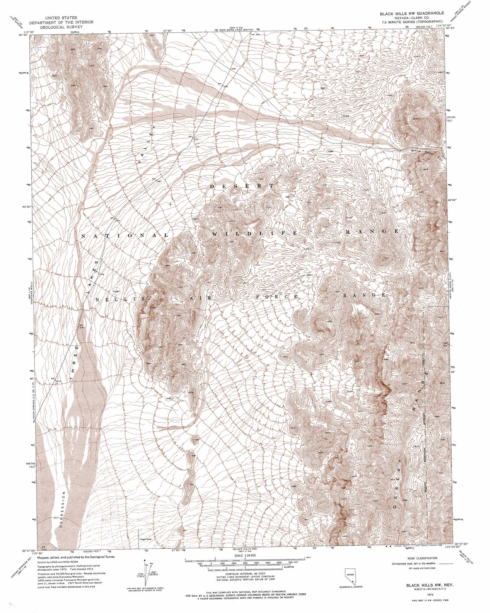
USGS Topo Quad 36115f4 - 1:24,000 scale
| Topo Map Name: | Black Hills Nw |
| USGS Topo Quad ID: | 36115f4 |
| Print Size: | ca. 21 1/4" wide x 27" high |
| Southeast Coordinates: | 36.625° N latitude / 115.375° W longitude |
| Map Center Coordinates: | 36.6875° N latitude / 115.4375° W longitude |
| U.S. State: | NV |
| Filename: | o36115f4.jpg |
| Download Map JPG Image: | Black Hills Nw topo map 1:24,000 scale |
| Map Type: | Topographic |
| Topo Series: | 7.5´ |
| Map Scale: | 1:24,000 |
| Source of Map Images: | United States Geological Survey (USGS) |
| Alternate Map Versions: |
Black Hills NW NV 1973, updated 1976 Download PDF Buy paper map |
1:24,000 Topo Quads surrounding Black Hills Nw
Quartz Peak Nw |
Quartz Peak |
Dog Bone Lake North |
Burro Basin |
Mule Deer Ridge Nw |
Quartz Peak Sw |
Tim Spring |
Dog Bone Lake South |
Dead Horse Ridge |
Mule Deer Ridge |
Indian Springs Nw |
Heavens Well |
Black Hills Nw |
White Sage Flat |
Hayford Peak |
Indian Springs |
Indian Springs Se |
Black Hills Sw |
Black Hills |
Sheep Peak |
Cold Creek |
Charleston Peak Ne |
Corn Creek Springs Nw |
Corn Creek Springs |
Gass Peak |
> Back to 36115e1 at 1:100,000 scale
> Back to 36114a1 at 1:250,000 scale
> Back to U.S. Topo Maps home
Black Hills Nw topo map: Gazetteer
Black Hills Nw: Parks
Desert National Wildlife Range elevation 1423m 4668′Black Hills Nw: Valleys
White Sage Gap elevation 1194m 3917′Black Hills Nw digital topo map on disk
Buy this Black Hills Nw topo map showing relief, roads, GPS coordinates and other geographical features, as a high-resolution digital map file on DVD:
Southern Sierra Nevada, California & Southern Nevada
Buy digital topo maps: Southern Sierra Nevada, California & Southern Nevada