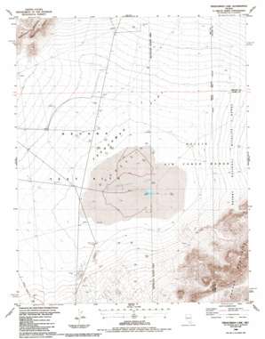
Frenchman Lake Topo Map Nevada
To zoom in, hover over the map of Frenchman Lake
USGS Topo Quad 36115g8 - 1:24,000 scale
| Topo Map Name: | Frenchman Lake |
| USGS Topo Quad ID: | 36115g8 |
| Print Size: | ca. 21 1/4" wide x 27" high |
| Southeast Coordinates: | 36.75° N latitude / 115.875° W longitude |
| Map Center Coordinates: | 36.8125° N latitude / 115.9375° W longitude |
| U.S. State: | NV |
| Filename: | o36115g8.jpg |
| Download Map JPG Image: | Frenchman Lake topo map 1:24,000 scale |
| Map Type: | Topographic |
| Topo Series: | 7.5´ |
| Map Scale: | 1:24,000 |
| Source of Map Images: | United States Geological Survey (USGS) |
| Alternate Map Versions: |
Frenchman Flat NV 1960, updated 1962 Download PDF Buy paper map Frenchman Flat NV 1960, updated 1983 Download PDF Buy paper map Frenchman Flat NV 1960, updated 1984 Download PDF Buy paper map Frenchman Lake NV 1986, updated 1987 Download PDF Buy paper map |
1:24,000 Topo Quads surrounding Frenchman Lake
> Back to 36115e1 at 1:100,000 scale
> Back to 36114a1 at 1:250,000 scale
> Back to U.S. Topo Maps home
Frenchman Lake topo map: Gazetteer
Frenchman Lake: Arroyos
Winapi Wash elevation 945m 3100′Frenchman Lake: Flats
Frenchman Flat elevation 946m 3103′Frenchman Lake: Lakes
Frenchman Lake elevation 939m 3080′Frenchman Lake: Populated Places
Sugar Bunker elevation 965m 3166′Frenchman Lake: Streams
Cane Spring Wash elevation 939m 3080′Frenchman Lake: Wells
Well Five A elevation 943m 3093′Well Five C elevation 940m 3083′
Well One elevation 945m 3100′
Frenchman Lake digital topo map on disk
Buy this Frenchman Lake topo map showing relief, roads, GPS coordinates and other geographical features, as a high-resolution digital map file on DVD:
Southern Sierra Nevada, California & Southern Nevada
Buy digital topo maps: Southern Sierra Nevada, California & Southern Nevada


