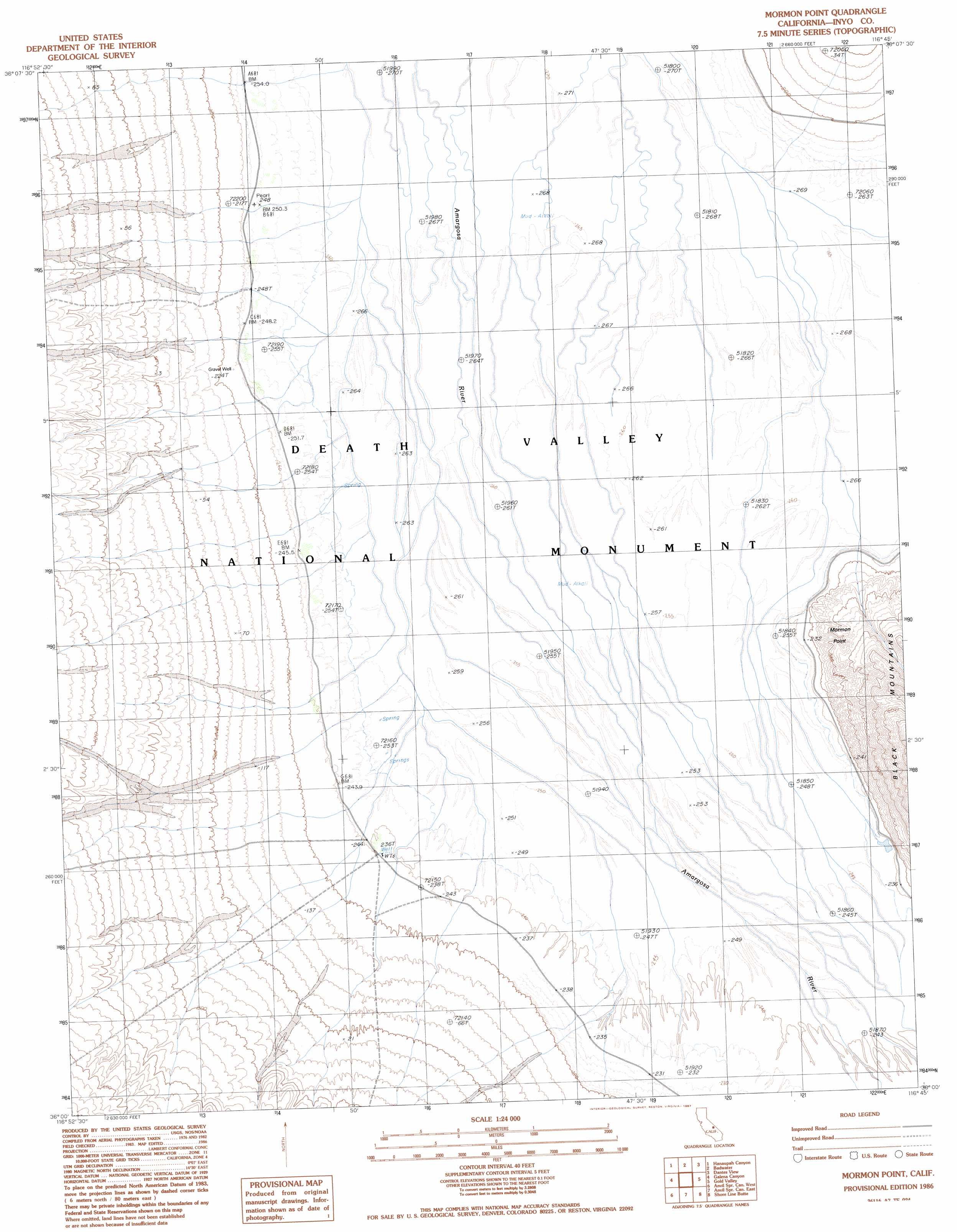
Mormon Point Topo Map California
To zoom in, hover over the map of Mormon Point
USGS Topo Quad 36116a7 - 1:24,000 scale
| Topo Map Name: | Mormon Point |
| USGS Topo Quad ID: | 36116a7 |
| Print Size: | ca. 21 1/4" wide x 27" high |
| Southeast Coordinates: | 36° N latitude / 116.75° W longitude |
| Map Center Coordinates: | 36.0625° N latitude / 116.8125° W longitude |
| U.S. State: | CA |
| Filename: | o36116a7.jpg |
| Download Map JPG Image: | Mormon Point topo map 1:24,000 scale |
| Map Type: | Topographic |
| Topo Series: | 7.5´ |
| Map Scale: | 1:24,000 |
| Source of Map Images: | United States Geological Survey (USGS) |
| Alternate Map Versions: |
Mormon Point CA 1986, updated 1987 Download PDF Buy paper map Mormon Point CA 2012 Download PDF Buy paper map Mormon Point CA 2015 Download PDF Buy paper map |
1:24,000 Topo Quads surrounding Mormon Point
Wildrose Peak |
Devils Speedway |
Devils Golf Course |
Ryan |
East Of Ryan |
Telescope Peak |
Hanaupah Canyon |
Badwater |
Dantes View |
Greenwater Canyon |
Panamint |
Galena Canyon |
Mormon Point |
Gold Valley |
Funeral Peak |
Manly Peak |
Anvil Spring Canyon West |
Anvil Spring Canyon East |
Shore Line Butte |
Epaulet Peak |
Sourdough Spring |
Wingate Wash West |
Wingate Wash East |
Confidence Hills West |
Confidence Hills East |
> Back to 36116a1 at 1:100,000 scale
> Back to 36116a1 at 1:250,000 scale
> Back to U.S. Topo Maps home
Mormon Point topo map: Gazetteer
Mormon Point: Capes
Mormon Point elevation 64m 209′Mormon Point: Wells
Gravel Well elevation -72m -237′Mormon Point digital topo map on disk
Buy this Mormon Point topo map showing relief, roads, GPS coordinates and other geographical features, as a high-resolution digital map file on DVD:
Southern Sierra Nevada, California & Southern Nevada
Buy digital topo maps: Southern Sierra Nevada, California & Southern Nevada