Dantes View Topo Map California
To zoom in, hover over the map of Dantes View
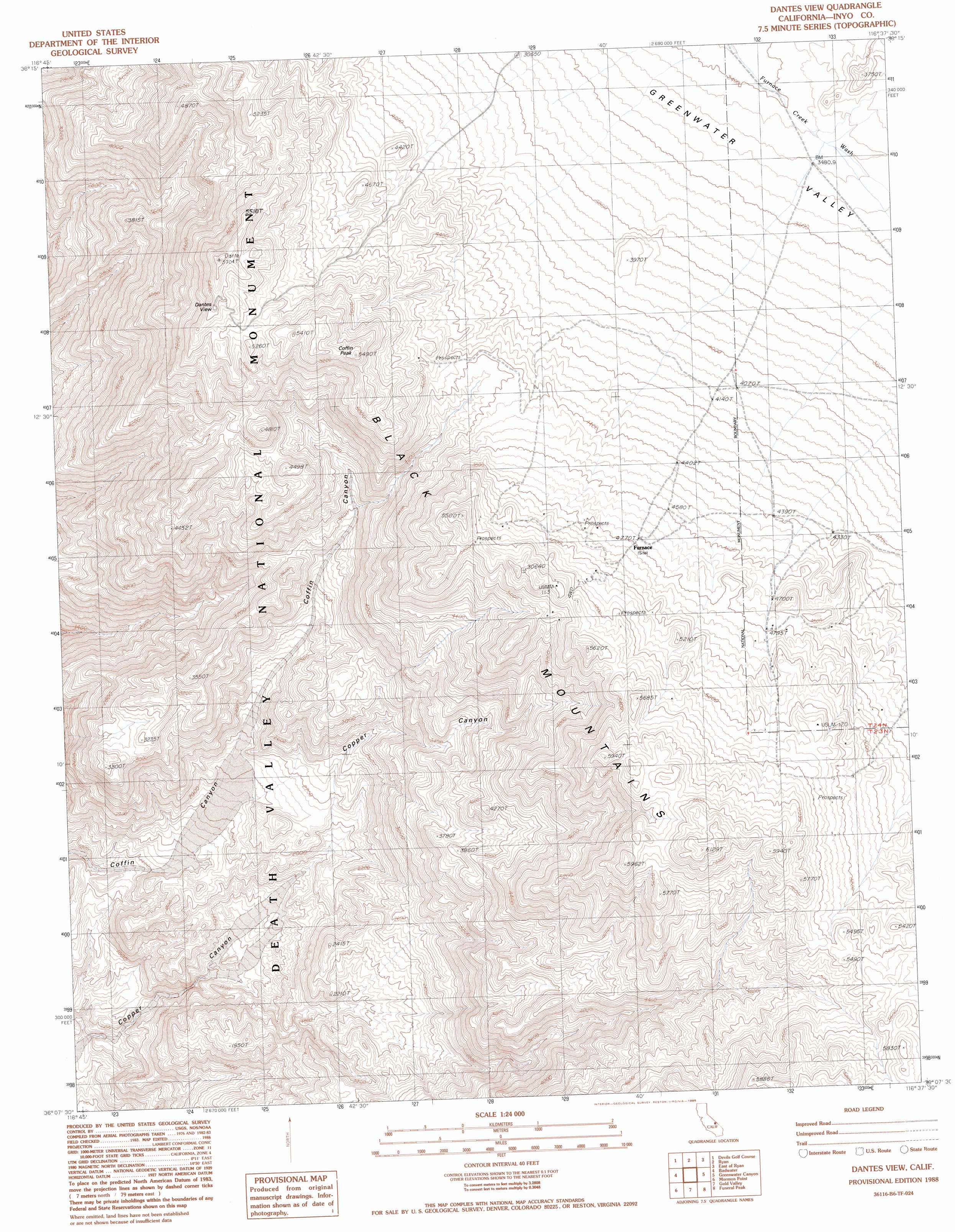
USGS Topo Quad 36116b6 - 1:24,000 scale
| Topo Map Name: | Dantes View |
| USGS Topo Quad ID: | 36116b6 |
| Print Size: | ca. 21 1/4" wide x 27" high |
| Southeast Coordinates: | 36.125° N latitude / 116.625° W longitude |
| Map Center Coordinates: | 36.1875° N latitude / 116.6875° W longitude |
| U.S. State: | CA |
| Filename: | o36116b6.jpg |
| Download Map JPG Image: | Dantes View topo map 1:24,000 scale |
| Map Type: | Topographic |
| Topo Series: | 7.5´ |
| Map Scale: | 1:24,000 |
| Source of Map Images: | United States Geological Survey (USGS) |
| Alternate Map Versions: |
Dantes View CA 1988, updated 1988 Download PDF Buy paper map Dantes View CA 1988, updated 1988 Download PDF Buy paper map Dantes View CA 2012 Download PDF Buy paper map Dantes View CA 2015 Download PDF Buy paper map |
1:24,000 Topo Quads surrounding Dantes View
East Of Furnace Creek |
Furnace Creek |
Echo Canyon |
East Of Echo Canyon |
Franklin Well |
Devils Speedway |
Devils Golf Course |
Ryan |
East Of Ryan |
Death Valley Junction |
Hanaupah Canyon |
Badwater |
Dantes View |
Greenwater Canyon |
West Of Eagle Mountain |
Galena Canyon |
Mormon Point |
Gold Valley |
Funeral Peak |
Deadman Pass |
Anvil Spring Canyon West |
Anvil Spring Canyon East |
Shore Line Butte |
Epaulet Peak |
Salsberry Peak |
> Back to 36116a1 at 1:100,000 scale
> Back to 36116a1 at 1:250,000 scale
> Back to U.S. Topo Maps home
Dantes View topo map: Gazetteer
Dantes View: Ranges
Black Mountains elevation 1645m 5396′Dantes View: Summits
Coffin Peak elevation 1673m 5488′Dantes View elevation 1639m 5377′
Dantes View digital topo map on disk
Buy this Dantes View topo map showing relief, roads, GPS coordinates and other geographical features, as a high-resolution digital map file on DVD:
Southern Sierra Nevada, California & Southern Nevada
Buy digital topo maps: Southern Sierra Nevada, California & Southern Nevada