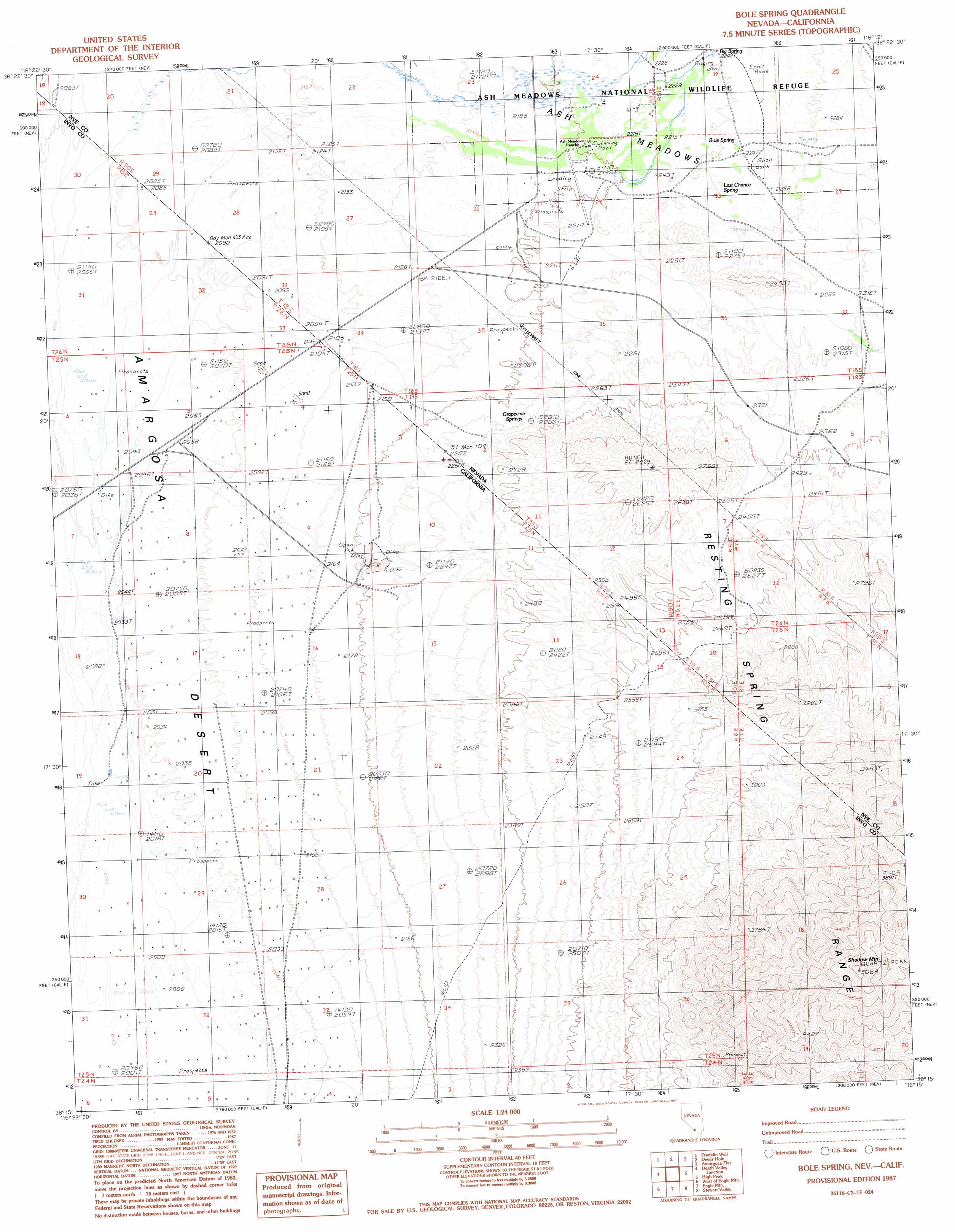
Bole Spring Topo Map California
To zoom in, hover over the map of Bole Spring
USGS Topo Quad 36116c3 - 1:24,000 scale
| Topo Map Name: | Bole Spring |
| USGS Topo Quad ID: | 36116c3 |
| Print Size: | ca. 21 1/4" wide x 27" high |
| Southeast Coordinates: | 36.25° N latitude / 116.25° W longitude |
| Map Center Coordinates: | 36.3125° N latitude / 116.3125° W longitude |
| U.S. States: | CA, NV |
| Filename: | o36116c3.jpg |
| Download Map JPG Image: | Bole Spring topo map 1:24,000 scale |
| Map Type: | Topographic |
| Topo Series: | 7.5´ |
| Map Scale: | 1:24,000 |
| Source of Map Images: | United States Geological Survey (USGS) |
| Alternate Map Versions: |
Bole Spring NV 1987, updated 1987 Download PDF Buy paper map Bole Spring NV 2012 Download PDF Buy paper map Bole Spring NV 2014 Download PDF Buy paper map |
1:24,000 Topo Quads surrounding Bole Spring
Leeland |
South Of Amargosa Valley |
Skeleton Hills |
Specter Range Sw |
Point Of Rocks |
East Of Echo Canyon |
Franklin Well |
Devils Hole |
Amargosa Flat |
Mount Schader |
East Of Ryan |
Death Valley Junction |
Bole Spring |
High Peak |
Last Chance Range |
Greenwater Canyon |
West Of Eagle Mountain |
Eagle Mountain |
Stewart Valley |
Sixmile Spring |
Funeral Peak |
Deadman Pass |
East Of Deadman Pass |
Twelve Mile Spring |
Nopah Peak |
> Back to 36116a1 at 1:100,000 scale
> Back to 36116a1 at 1:250,000 scale
> Back to U.S. Topo Maps home
Bole Spring topo map: Gazetteer
Bole Spring: Airports
Ash Meadows Airport elevation 670m 2198′Bole Spring: Populated Places
Ashmeadow (historical) elevation 669m 2194′Bole Spring: Springs
Big Spring elevation 684m 2244′Bole Spring elevation 686m 2250′
Bramer Spring elevation 694m 2276′
Grapevine Springs elevation 697m 2286′
Last Chance Spring elevation 686m 2250′
Winters Holes elevation 708m 2322′
Bole Spring: Summits
Shadow Mountain elevation 1543m 5062′Bole Spring digital topo map on disk
Buy this Bole Spring topo map showing relief, roads, GPS coordinates and other geographical features, as a high-resolution digital map file on DVD:
Southern Sierra Nevada, California & Southern Nevada
Buy digital topo maps: Southern Sierra Nevada, California & Southern Nevada