South Of Amargosa Valley Topo Map Nevada
To zoom in, hover over the map of South Of Amargosa Valley
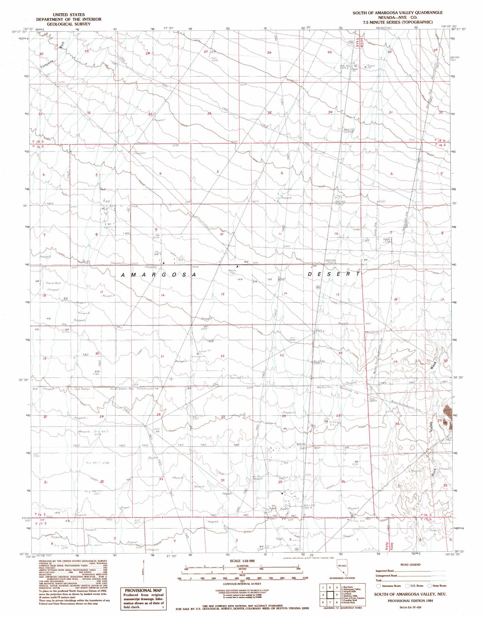
USGS Topo Quad 36116e4 - 1:24,000 scale
| Topo Map Name: | South Of Amargosa Valley |
| USGS Topo Quad ID: | 36116e4 |
| Print Size: | ca. 21 1/4" wide x 27" high |
| Southeast Coordinates: | 36.5° N latitude / 116.375° W longitude |
| Map Center Coordinates: | 36.5625° N latitude / 116.4375° W longitude |
| U.S. State: | NV |
| Filename: | o36116e4.jpg |
| Download Map JPG Image: | South Of Amargosa Valley topo map 1:24,000 scale |
| Map Type: | Topographic |
| Topo Series: | 7.5´ |
| Map Scale: | 1:24,000 |
| Source of Map Images: | United States Geological Survey (USGS) |
| Alternate Map Versions: |
South of Amargosa Valley NV 1984, updated 1984 Download PDF Buy paper map South of Amargosa Valley NV 2012 Download PDF Buy paper map South of Amargosa Valley NV 2015 Download PDF Buy paper map |
1:24,000 Topo Quads surrounding South Of Amargosa Valley
Carrara Canyon |
Crater Flat |
Busted Butte |
Jackass Flats |
Skull Mountain |
Ashton |
Big Dune |
Lathrop Wells |
Striped Hills |
Specter Range Nw |
Lees Camp |
Leeland |
South Of Amargosa Valley |
Skeleton Hills |
Specter Range Sw |
Echo Canyon |
East Of Echo Canyon |
Franklin Well |
Devils Hole |
Amargosa Flat |
Ryan |
East Of Ryan |
Death Valley Junction |
Bole Spring |
High Peak |
> Back to 36116e1 at 1:100,000 scale
> Back to 36116a1 at 1:250,000 scale
> Back to U.S. Topo Maps home
South Of Amargosa Valley topo map: Gazetteer
South Of Amargosa Valley: Wells
Millers Well Number One elevation 745m 2444′South Of Amargosa Valley digital topo map on disk
Buy this South Of Amargosa Valley topo map showing relief, roads, GPS coordinates and other geographical features, as a high-resolution digital map file on DVD:
Southern Sierra Nevada, California & Southern Nevada
Buy digital topo maps: Southern Sierra Nevada, California & Southern Nevada