Leeland Topo Map Nevada
To zoom in, hover over the map of Leeland
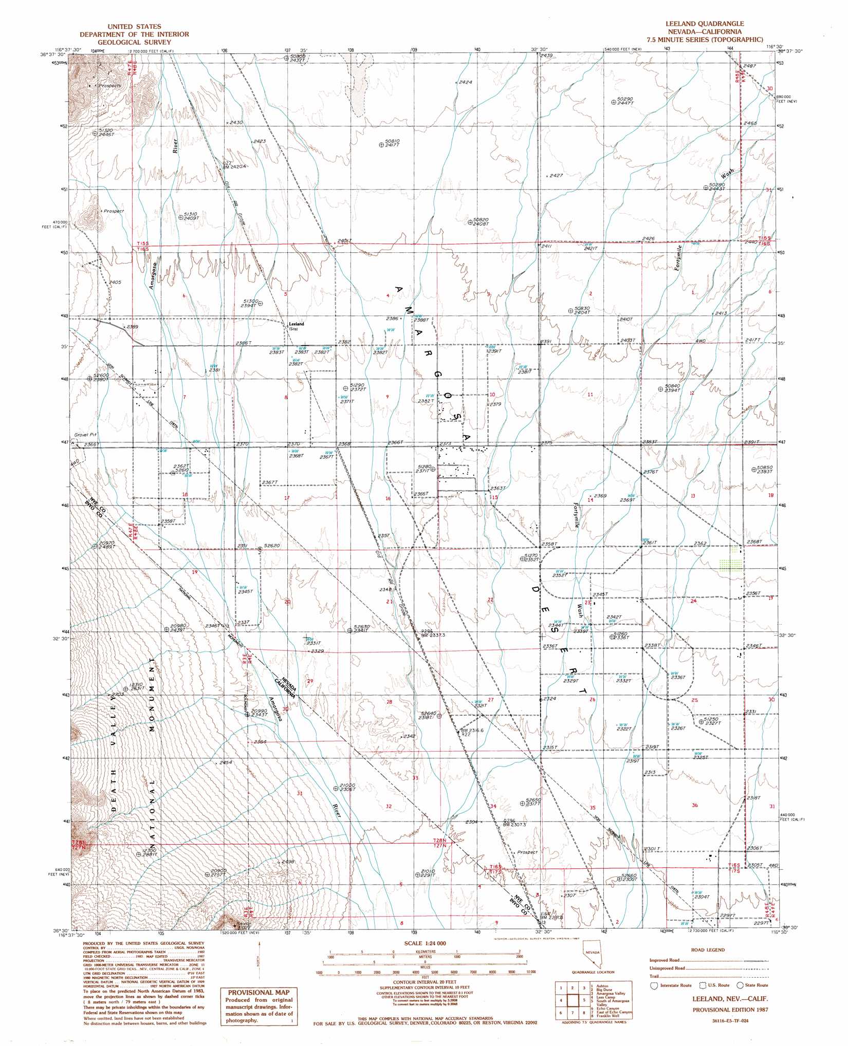
USGS Topo Quad 36116e5 - 1:24,000 scale
| Topo Map Name: | Leeland |
| USGS Topo Quad ID: | 36116e5 |
| Print Size: | ca. 21 1/4" wide x 27" high |
| Southeast Coordinates: | 36.5° N latitude / 116.5° W longitude |
| Map Center Coordinates: | 36.5625° N latitude / 116.5625° W longitude |
| U.S. States: | NV, CA |
| Filename: | o36116e5.jpg |
| Download Map JPG Image: | Leeland topo map 1:24,000 scale |
| Map Type: | Topographic |
| Topo Series: | 7.5´ |
| Map Scale: | 1:24,000 |
| Source of Map Images: | United States Geological Survey (USGS) |
| Alternate Map Versions: |
Leeland NV 1987, updated 1987 Download PDF Buy paper map Leeland NV 2012 Download PDF Buy paper map Leeland NV 2014 Download PDF Buy paper map |
1:24,000 Topo Quads surrounding Leeland
Gold Center |
Carrara Canyon |
Crater Flat |
Busted Butte |
Jackass Flats |
East Of Chloride City |
Ashton |
Big Dune |
Lathrop Wells |
Striped Hills |
Nevares Peak |
Lees Camp |
Leeland |
South Of Amargosa Valley |
Skeleton Hills |
Furnace Creek |
Echo Canyon |
East Of Echo Canyon |
Franklin Well |
Devils Hole |
Devils Golf Course |
Ryan |
East Of Ryan |
Death Valley Junction |
Bole Spring |
> Back to 36116e1 at 1:100,000 scale
> Back to 36116a1 at 1:250,000 scale
> Back to U.S. Topo Maps home
Leeland topo map: Gazetteer
Leeland: Plains
Amargosa Desert elevation 735m 2411′Leeland: Populated Places
Leeland (historical) elevation 729m 2391′Leeland: Post Offices
Leeland Post Office elevation 729m 2391′Leeland digital topo map on disk
Buy this Leeland topo map showing relief, roads, GPS coordinates and other geographical features, as a high-resolution digital map file on DVD:
Southern Sierra Nevada, California & Southern Nevada
Buy digital topo maps: Southern Sierra Nevada, California & Southern Nevada